Ksibet el Mediouni night lights from space
Night Light of Ksibet el Mediouni (Al Munastīr) from space (Tunisia) Src. Average luminocity for 10x10km area is 47.9808% and for 50x50km: 18.8593%.
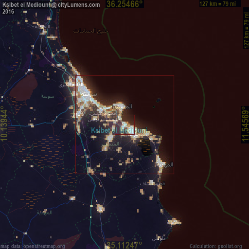
Analysis of Ksibet el Mediouni night lights 2016
Square area 10x10 km:
 9.09%
9.09%90-99
10.49%80-89
5.59%70-79
4.37%60-69
6.12%50-59
2.1%40-49
5.24%30-39
10.14%20-29
34.79%10-19
10.31%0-9
1.75%Square area 50x50 km:
2.86%90-99
2.95%80-89
2.57%70-79
2.08%60-69
2.99%50-59
1.47%40-49
2.38%30-39
3.52%20-29
6.72%10-19
12.2%0-9
60.25%Clear (daylight) street map image can be seen on geolist.org.
Map coordinates:
36° 15' 16.8" North, 10° 8' 22" East
35° 41' 8.2" North, 10° 50' 33.2" East
35° 6' 44.9" North, 11° 32' 44.5" East
Some cities around Ksibet el Mediouni sort by population:
• Monastir
10.4 km =6.5 mi,  351°
351°
• Skanes
11.5 km =7.1 mi,  340°
340°
• Djemmal
10.5 km =6.5 mi,  227°
227°
• Ksar Hellal
6 km =3.7 mi,  134°
134°
• Seïada
4.9 km =3 mi,  112°
112°
• Banbalah
4.2 km =2.6 mi,  292°
292°
• Touza
5.7 km =3.5 mi,  193°
193°
• Lemta
4.2 km =2.6 mi,  119°
119°
2467890 (p: 11,313)
Sources (retrieved 2019-11-25):
» Earth at Night: Flat Maps 2012, 2016