Menzel Jemil night lights from space
Night Light of Menzel Jemil (Banzart) from space (Tunisia) Src. Average luminocity for 10x10km area is 36.7092% and for 50x50km: 6.4567%.
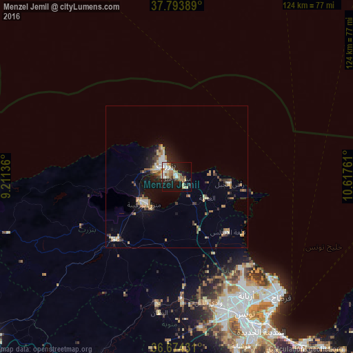
Analysis of Menzel Jemil night lights 2016
Square area 10x10 km:
 5.1%
5.1%90-99
8.5%80-89
4.59%70-79
4.59%60-69
6.63%50-59
4.59%40-49
1.02%30-39
3.23%20-29
9.35%10-19
29.08%0-9
23.3%Square area 50x50 km:
0.65%90-99
0.88%80-89
0.84%70-79
0.9%60-69
1.17%50-59
0.64%40-49
0.62%30-39
0.94%20-29
1.34%10-19
4.15%0-9
87.85%Clear (daylight) street map image can be seen on geolist.org.
Map coordinates:
37° 47' 38" North, 9° 12' 40.9" East
37° 14' 10.2" North, 9° 54' 52.1" East
36° 40' 27.5" North, 10° 37' 3.4" East
Some cities around Menzel Jemil sort by population:
• Bizerte
5.6 km =3.5 mi,  319°
319°
• Mateur
31 km =19.3 mi,  225°
225°
• Douar Tindja
16.5 km =10.3 mi,  242°
242°
• El Alia
13 km =8.1 mi,  124°
124°
• Galaat el Andeless
26.4 km =16.4 mi,  136°
136°
• Rafrāf
24.4 km =15.2 mi,  102°
102°
• Al Matlīn
12 km =7.5 mi,  85°
85°
• Rhar el Melah
25.6 km =15.9 mi,  106°
106°
2469256 (p: 21,542)
Sources (retrieved 2019-11-25):
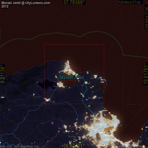
» Earth at Night: Flat Maps 2012, 2016