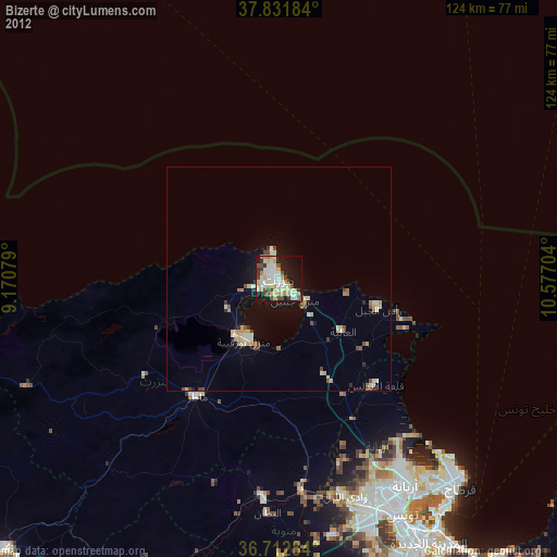
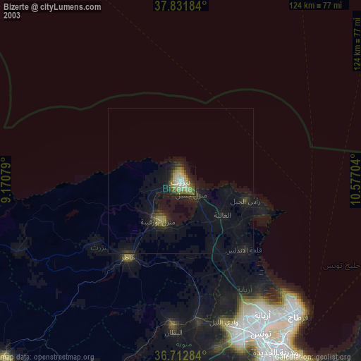
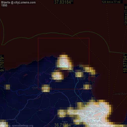
Bizerte night lights from space
Night Light of Bizerte (Banzart) from space (Tunisia) Src. Average luminocity for 10x10km area is 55.2653% and for 50x50km: 5.8297%.
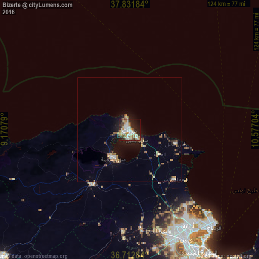
Analysis of Bizerte night lights 2016
Square area 10x10 km:
 12.24%
90-99
14.29%80-89
6.12%70-79
7.31%60-69
9.35%50-59
3.57%40-49
4.76%30-39
6.29%20-29
14.97%10-19
16.84%0-9
4.25%Square area 50x50 km:
0.61%90-99
0.78%80-89
0.74%70-79
0.76%60-69
1.09%50-59
0.59%40-49
0.55%30-39
0.8%20-29
1.23%10-19
4.14%0-9
88.7%Clear (daylight) street map image can be seen on geolist.org.
Map coordinates:
37° 49' 54.6" North, 9° 10' 14.8" East
37° 16' 27.9" North, 9° 52' 26.1" East
36° 42' 46.2" North, 10° 34' 37.3" East
Some cities around Bizerte sort by population:
• Menzel Bourguiba
15.5 km =9.6 mi,  210°
210°
• Menzel Jemil
5.6 km =3.5 mi,  139°
139°
• Douar Tindja
16.2 km =10.1 mi,  222°
222°
• El Alia
18.4 km =11.4 mi,  129°
129°
• Menzel Abderhaman
4.2 km =2.6 mi,  193°
193°
• Rafrāf
29 km =18 mi,  108°
108°
• Al Matlīn
15.9 km =9.9 mi,  101°
101°
• Rhar el Melah
30.4 km =18.9 mi, 112°
2472706 (p: 115,268)
Sources (retrieved 2019-11-25):
» NASA, Earths city lights 1995
» NASA city lights 2003
» Earth at Night: Flat Maps 2012, 2016