La Mohammedia night lights from space
Night Light of La Mohammedia (Tūnis) from space (Tunisia) Src. Average luminocity for 10x10km area is 51.163% and for 50x50km: 27.1983%.
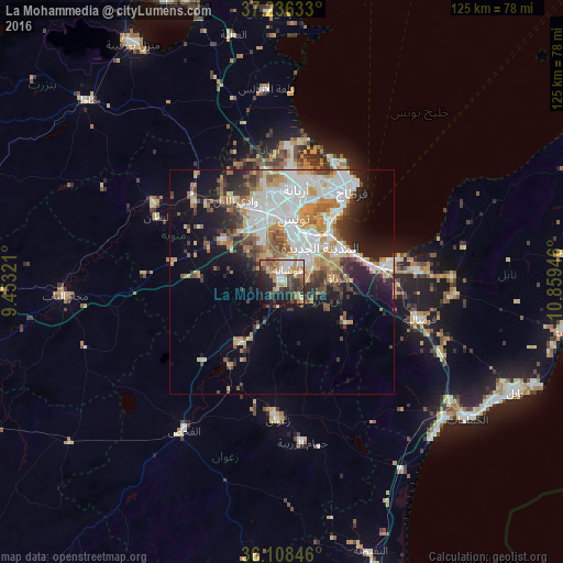
Analysis of La Mohammedia night lights 2016
Square area 10x10 km:
 6.96%
6.96%90-99
8.42%80-89
8.61%70-79
8.42%60-69
11.72%50-59
5.86%40-49
6.41%30-39
8.97%20-29
14.1%10-19
16.12%0-9
4.4%Square area 50x50 km:
6.85%90-99
5.28%80-89
2.85%70-79
4%60-69
3.75%50-59
2.89%40-49
3%30-39
3.29%20-29
4.52%10-19
9.26%0-9
54.31%Clear (daylight) street map image can be seen on geolist.org.
Map coordinates:
37° 14' 10.8" North, 9° 27' 11.6" East
36° 40' 28.1" North, 10° 9' 22.8" East
36° 6' 30.5" North, 10° 51' 34.1" East
Some cities around La Mohammedia sort by population:
• Tunis
16.1 km =10 mi,  3°
3°
• La Goulette
20.8 km =12.9 mi,  39°
39°
• Ben Arous
10.6 km =6.6 mi,  33°
33°
• Hammam-Lif
17.6 km =10.9 mi,  69°
69°
• Oued Lill
20.5 km =12.7 mi,  329°
329°
• Radès
14.9 km =9.3 mi, 44°
• La Sebala du Mornag
12.1 km =7.5 mi,  87°
87°
• Manouba
16 km =9.9 mi,  340°
340°
2473499 (p: 66,593)
Sources (retrieved 2019-11-25):
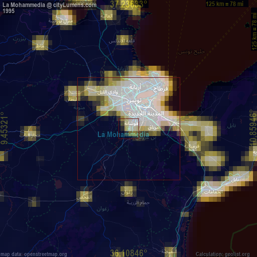
» NASA, Earths city lights 1995
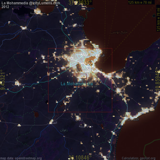
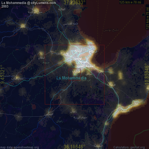
» NASA city lights 2003
» Earth at Night: Flat Maps 2012, 2016