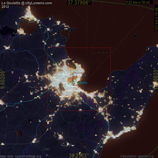
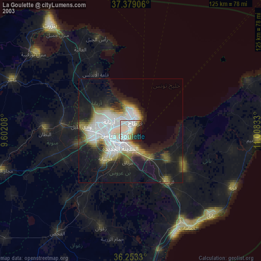
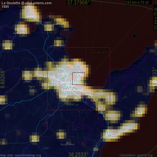
La Goulette night lights from space
Night Light of La Goulette (Tūnis) from space (Tunisia) Src. Average luminocity for 10x10km area is 61.7841% and for 50x50km: 30.2436%.
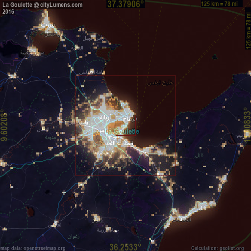
Analysis of La Goulette night lights 2016
Square area 10x10 km:
 19.16%
90-99
15.91%80-89
1.62%70-79
11.85%60-69
7.14%50-59
5.52%40-49
4.55%30-39
6.66%20-29
13.31%10-19
12.5%0-9
1.79%Square area 50x50 km:
7.15%90-99
5.72%80-89
3.21%70-79
4.38%60-69
4.43%50-59
3.09%40-49
3.66%30-39
3.98%20-29
5.99%10-19
13.03%0-9
45.37%Clear (daylight) street map image can be seen on geolist.org.
Map coordinates:
37° 22' 44.6" North, 9° 36' 7.5" East
36° 49' 5.7" North, 10° 18' 18.7" East
36° 15' 11.9" North, 11° 0' 30" East
Some cities around La Goulette sort by population:
• Tunis
12.4 km =7.7 mi,  270°
270°
• Ariana
11 km =6.8 mi,  295°
295°
• Ben Arous
10.3 km =6.4 mi,  226°
226°
• Al Marsá
6.9 km =4.3 mi,  14°
14°
• Hammam-Lif
10.5 km =6.5 mi,  161°
161°
• Radès
6.1 km =3.8 mi,  206°
206°
• La Sebala du Mornag
15.5 km =9.6 mi,  184°
184°
• Carthage
5.3 km =3.3 mi,  26°
26°
2470656 (p: 79,795)
Sources (retrieved 2019-11-25):
» NASA, Earths city lights 1995
» NASA city lights 2003
» Earth at Night: Flat Maps 2012, 2016