Ben Arous night lights from space
Night Light of Ben Arous (Bin ‘Arūs) from space (Tunisia) Src. Average luminocity for 10x10km area is 89.7255% and for 50x50km: 31.2059%.
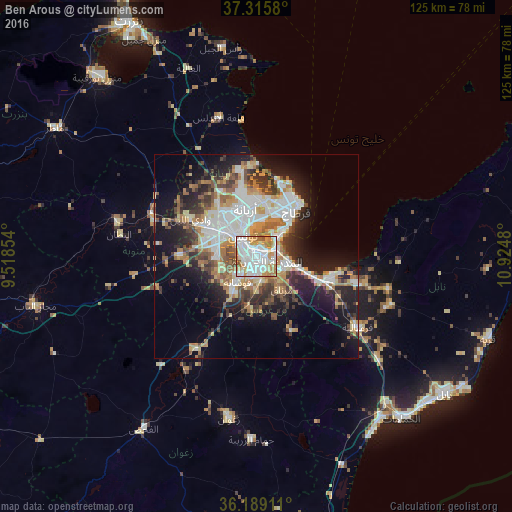
Analysis of Ben Arous night lights 2016
Square area 10x10 km:
 37.76%
90-99
26.22%80-89
8.39%70-79
17.31%60-69
7.69%50-59
2.45%40-49
0.17%30-39
0%20-29
0%10-19
0%0-9
0%Square area 50x50 km:
7.24%90-99
5.79%80-89
3.27%70-79
4.51%60-69
4.7%50-59
3.16%40-49
3.79%30-39
4.3%20-29
6.33%10-19
13.33%0-9
43.58%Clear (daylight) street map image can be seen on geolist.org.
Map coordinates:
37° 18' 56.9" North, 9° 31' 6.7" East
36° 45' 16.3" North, 10° 13' 18" East
36° 11' 20.8" North, 10° 55' 29.3" East
Some cities around Ben Arous sort by population:
• Tunis
8.7 km =5.4 mi,  325°
325°
• Ariana
12 km =7.5 mi,  347°
347°
• La Goulette
10.3 km =6.4 mi,  46°
46°
• La Mohammedia
10.6 km =6.6 mi,  213°
213°
• Hammam-Lif
11.1 km =6.9 mi,  105°
105°
• Radès
5 km =3.1 mi,  70°
70°
• La Sebala du Mornag
10.4 km =6.5 mi,  143°
143°
• Manouba
12.8 km =8 mi,  298°
298°
2472479 (p: 74,932)
Sources (retrieved 2019-11-25):
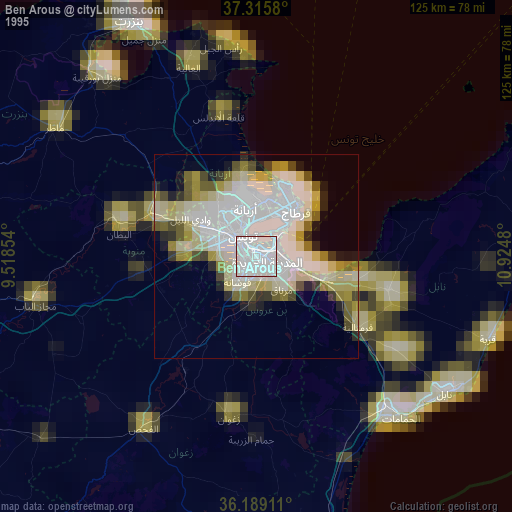
» NASA, Earths city lights 1995
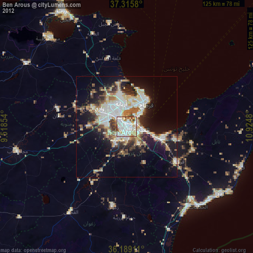
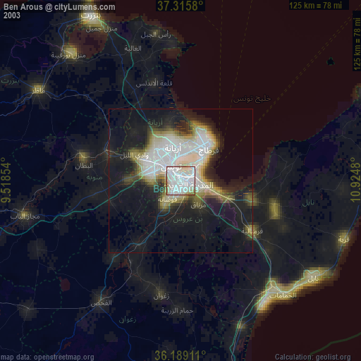
» NASA city lights 2003
» Earth at Night: Flat Maps 2012, 2016