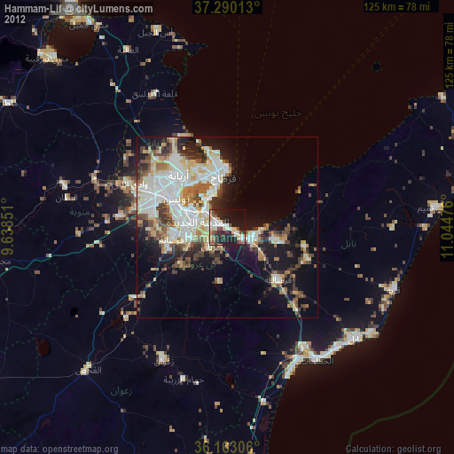
Hammam-Lif night lights from space
Night Light of Hammam-Lif (Bin ‘Arūs) from space (Tunisia) Src. Average luminocity for 10x10km area is 44.0332% and for 50x50km: 30.3653%.
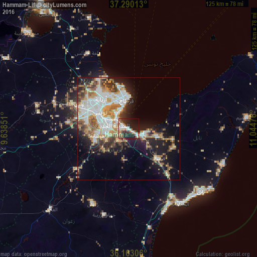
Analysis of Hammam-Lif night lights 2016
Square area 10x10 km:
 8.04%
8.04%90-99
7.34%80-89
4.37%70-79
6.29%60-69
7.17%50-59
3.32%40-49
4.9%30-39
8.39%20-29
21.5%10-19
22.73%0-9
5.94%Square area 50x50 km:
7.28%90-99
5.78%80-89
3.14%70-79
4.58%60-69
4.47%50-59
3%40-49
3.59%30-39
3.93%20-29
5.35%10-19
12.83%0-9
46.04%Clear (daylight) street map image can be seen on geolist.org.
Map coordinates:
37° 17' 24.5" North, 9° 38' 18.6" East
36° 43' 43.2" North, 10° 20' 29.9" East
36° 9' 47" North, 11° 2' 41.1" East
Some cities around Hammam-Lif sort by population:
• Tunis
18.6 km =11.6 mi,  302°
302°
• La Goulette
10.5 km =6.5 mi,  341°
341°
• Ben Arous
11.1 km =6.9 mi,  285°
285°
• La Mohammedia
17.6 km =10.9 mi,  249°
249°
• Al Marsá
16.7 km =10.4 mi,  354°
354°
• Radès
7.5 km =4.7 mi,  307°
307°
• La Sebala du Mornag
7.1 km =4.4 mi,  218°
218°
• Carthage
14.8 km =9.2 mi,  356°
356°
2470588 (p: 47,760)
Sources (retrieved 2019-11-25):
» Earth at Night: Flat Maps 2012, 2016