Ariana night lights from space
Night Light of Ariana from space (Tunisia) Src. Average luminocity for 10x10km area is 89.6997% and for 50x50km: 29.9732%.
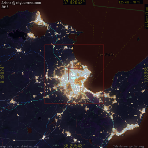
Analysis of Ariana night lights 2016
Square area 10x10 km:
 42.37%
90-99
25.49%80-89
5.03%70-79
14.94%60-69
6.66%50-59
4.22%40-49
1.14%30-39
0.16%20-29
0%10-19
0%0-9
0%Square area 50x50 km:
7.04%90-99
5.65%80-89
3.32%70-79
4.34%60-69
4.51%50-59
3.07%40-49
3.48%30-39
4.15%20-29
5.99%10-19
11.45%0-9
47.01%Clear (daylight) street map image can be seen on geolist.org.
Map coordinates:
37° 25' 14.2" North, 9° 29' 24.9" East
36° 51' 36.4" North, 10° 11' 36.1" East
36° 17' 43.7" North, 10° 53' 47.4" East
Some cities around Ariana sort by population:
• Tunis
5.2 km =3.2 mi,  208°
208°
• La Goulette
11 km =6.8 mi,  115°
115°
• Ben Arous
12 km =7.5 mi,  167°
167°
• Al Marsá
11.8 km =7.3 mi,  80°
80°
• Oued Lill
13.9 km =8.6 mi,  257°
257°
• Radès
12.4 km =7.7 mi,  144°
144°
• Manouba
10.3 km =6.4 mi,  237°
237°
• Carthage
12.3 km =7.6 mi,  89°
89°
2473247 (p: 97,687)
Sources (retrieved 2019-11-25):
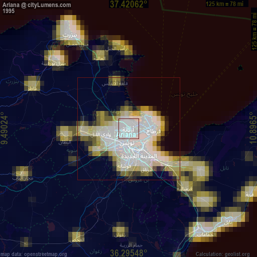
» NASA, Earths city lights 1995
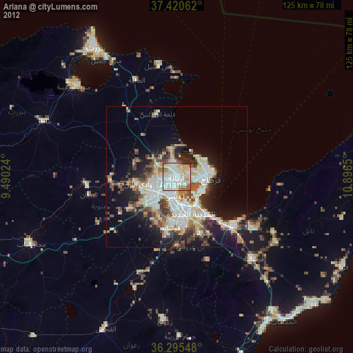
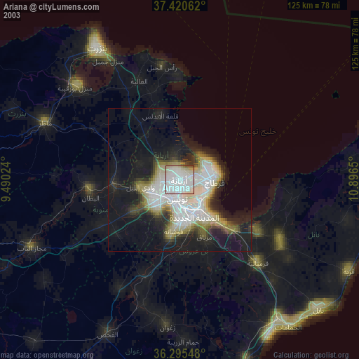
» NASA city lights 2003
» Earth at Night: Flat Maps 2012, 2016