Mashhad night lights from space
Night Light of Mashhad (Razavi Khorasan) from space (Iran) Src. Average luminocity for 10x10km area is 98.1486% and for 50x50km: 34.7377%.
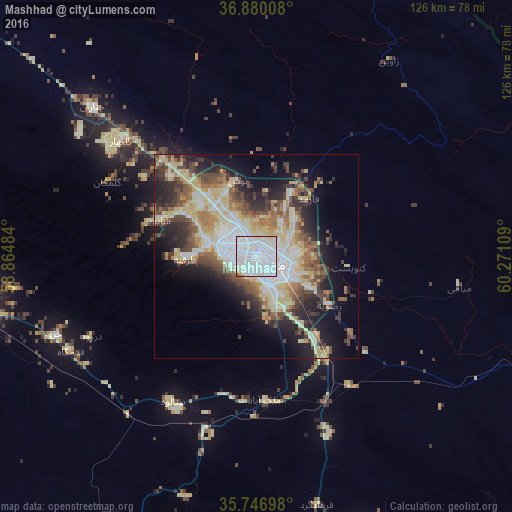
Analysis of Mashhad night lights 2016
Square area 10x10 km:
 69.76%
90-99
25%80-89
3.15%70-79
0.87%60-69
0.52%50-59
0.7%40-49
0%30-39
0%20-29
0%10-19
0%0-9
0%Square area 50x50 km:
7.39%90-99
6.72%80-89
7.26%70-79
2.58%60-69
3.92%50-59
4.22%40-49
5.49%30-39
4.66%20-29
7.1%10-19
11.17%0-9
39.48%Clear (daylight) street map image can be seen on geolist.org.
Map coordinates:
36° 52' 48.3" North, 58° 51' 53.4" East
36° 18' 56.1" North, 59° 34' 4.7" East
35° 44' 49.1" North, 60° 16' 15.9" East
Some cities around Mashhad sort by population:
• Neyshābūr
70.2 km =43.6 mi,  260°
260°
• Torbat-e Ḩeydarīyeh
120 km =74.6 mi,  195°
195°
• Qūchān
128.9 km =80.1 mi,  312°
312°
• Tejen, TM
145.1 km =90.2 mi,  35°
35°
• Torbat-e Jām
152.5 km =94.8 mi,  141°
141°
• Chenārān
54.2 km =33.7 mi, 312°
• Sarakhs
144.5 km =89.8 mi,  79°
79°
• Kaka, TM
114.9 km =71.4 mi,  2°
2°
124665 (p: 2,307,177)
Sources (retrieved 2019-11-25):
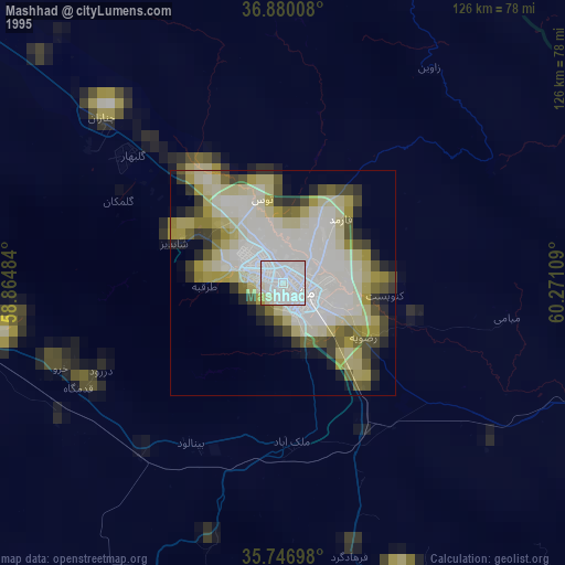
» NASA, Earths city lights 1995
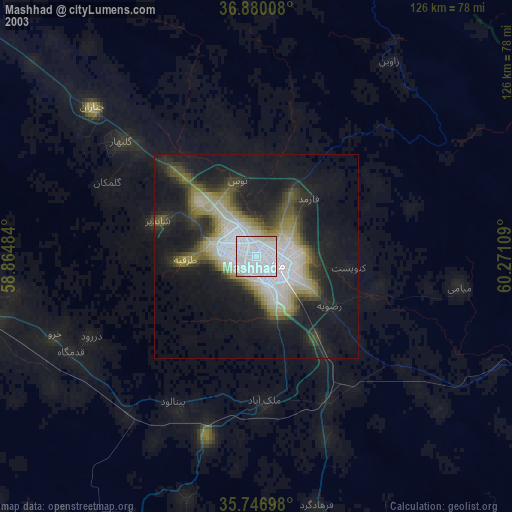
» NASA city lights 2003
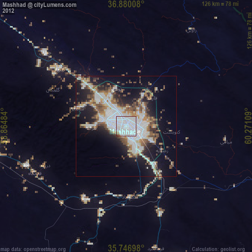
» Earth at Night: Flat Maps 2012, 2016