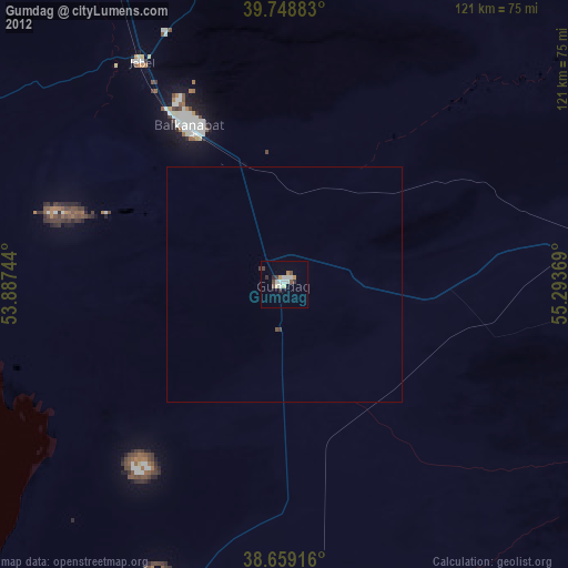
Gumdag night lights from space
Night Light of Gumdag (Balkan) from space (Turkmenistan) Src. Average luminocity for 10x10km area is 8.4269% and for 50x50km: 0.3509%.
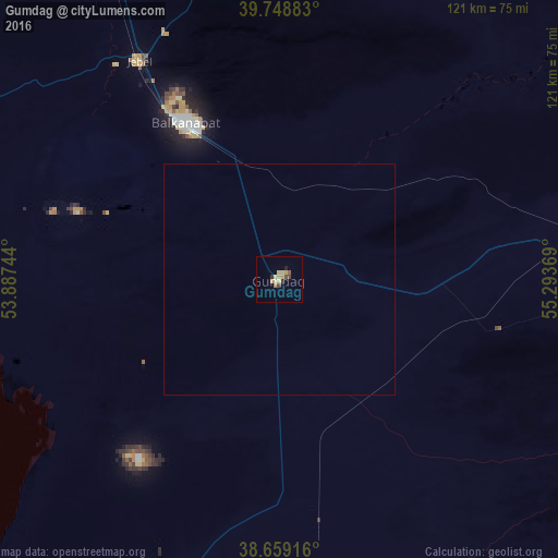
Analysis of Gumdag night lights 2016
Square area 10x10 km:
 0%
0%90-99
0%80-89
3.57%70-79
1.95%60-69
0.97%50-59
0.65%40-49
1.46%30-39
0.81%20-29
1.46%10-19
0.49%0-9
88.64%Square area 50x50 km:
0%90-99
0%80-89
0.15%70-79
0.08%60-69
0.04%50-59
0.03%40-49
0.06%30-39
0.03%20-29
0.06%10-19
0.02%0-9
99.54%Clear (daylight) street map image can be seen on geolist.org.
Map coordinates:
39° 44' 55.8" North, 53° 53' 14.8" East
39° 12' 22" North, 54° 35' 26" East
38° 39' 33" North, 55° 17' 37.3" East
Some cities around Gumdag sort by population:
• Gonbad-e Kāvūs, IR
223.2 km =138.7 mi,  166°
166°
• Balkanabat
38.9 km =24.2 mi,  330°
330°
• Türkmenbaşy
166.9 km =103.7 mi,  302°
302°
• Āzādshahr, IR
241.1 km =149.8 mi, 167°
• Kalāleh, IR
217.9 km =135.4 mi,  158°
158°
• Bereket
79.8 km =49.6 mi,  86°
86°
• Serdar
147.7 km =91.8 mi,  99°
99°
• Āq Qāyeh, IR
220.4 km =137 mi, 166°
161943 (p: 24,312)
Sources (retrieved 2019-11-25):
» Earth at Night: Flat Maps 2012, 2016