Türkmenbaşy night lights from space
Night Light of Türkmenbaşy (Balkan) from space (Turkmenistan) Src. Average luminocity for 10x10km area is 56.2435% and for 50x50km: 7.826%.
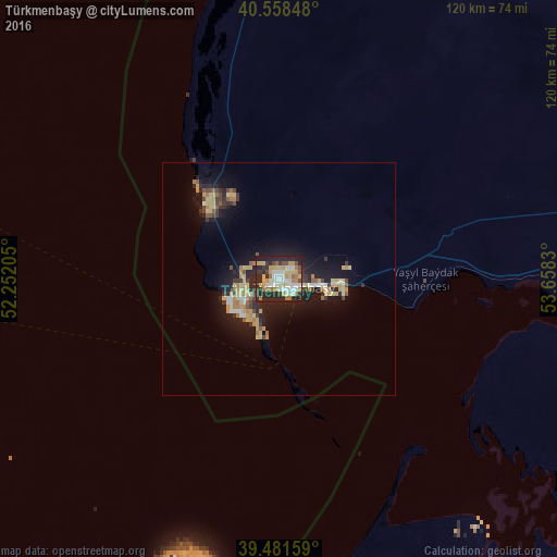

Analysis of Türkmenbaşy night lights 2016
Square area 10x10 km:
 11.04%
90-99
11.53%80-89
8.93%70-79
10.39%60-69
8.12%50-59
1.62%40-49
6.82%30-39
4.22%20-29
28.9%10-19
8.44%0-9
0%Square area 50x50 km:
0.72%90-99
0.81%80-89
1.55%70-79
1.37%60-69
0.97%50-59
0.6%40-49
1%30-39
1.1%20-29
2.9%10-19
6.46%0-9
82.52%Clear (daylight) street map image can be seen on geolist.org.
Map coordinates:
40° 33' 30.5" North, 52° 15' 7.4" East
40° 1' 19.8" North, 52° 57' 18.6" East
39° 28' 53.7" North, 53° 39' 29.9" East
Some cities around Türkmenbaşy sort by population:
• Balkanabat
133.4 km =82.9 mi,  115°
115°
• Hövsan, AZ
246.9 km =153.4 mi,  279°
279°
• Gumdag
166.9 km =103.7 mi, 122°
• Bereket
235.7 km =146.5 mi,  111°
111°
• Mardakan, AZ
244.3 km =151.8 mi, 282°
• Pirallahı, AZ
228.7 km =142.1 mi, 282°
• Zyrya, AZ
229.4 km =142.5 mi, 279°
• Türkan, AZ
235.3 km =146.2 mi, 279°
601594 (p: 68,292)
Sources (retrieved 2019-11-25):
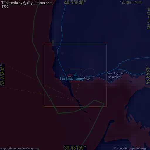
» NASA, Earths city lights 1995
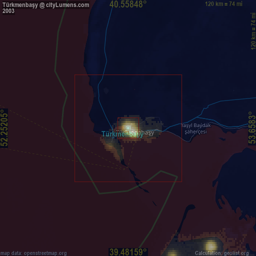
» NASA city lights 2003
» Earth at Night: Flat Maps 2012, 2016