Balkanabat night lights from space
Night Light of Balkanabat (Balkan) from space (Turkmenistan) Src. Average luminocity for 10x10km area is 45.8815% and for 50x50km: 3.2536%.
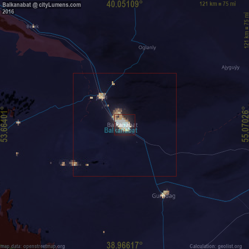

Analysis of Balkanabat night lights 2016
Square area 10x10 km:
 12.66%
90-99
10.06%80-89
6.17%70-79
7.14%60-69
2.6%50-59
2.44%40-49
1.46%30-39
2.6%20-29
15.75%10-19
29.38%0-9
9.74%Square area 50x50 km:
0.52%90-99
0.41%80-89
0.5%70-79
0.57%60-69
0.32%50-59
0.26%40-49
0.25%30-39
0.28%20-29
0.94%10-19
2.43%0-9
93.51%Clear (daylight) street map image can be seen on geolist.org.
Map coordinates:
40° 3' 3.9" North, 53° 39' 50.4" East
39° 30' 38.7" North, 54° 22' 1.7" East
38° 57' 58.2" North, 55° 4' 12.9" East
Some cities around Balkanabat sort by population:
• Gonbad-e Kāvūs, IR
260.9 km =162.1 mi,  164°
164°
• Türkmenbaşy
133.4 km =82.9 mi,  295°
295°
• Āzādshahr, IR
278.6 km =173.1 mi,  165°
165°
• Kalāleh, IR
256.5 km =159.4 mi, 157°
• Gumdag
38.9 km =24.2 mi,  150°
150°
• Bereket
103 km =64 mi,  106°
106°
• Serdar
174.8 km =108.6 mi, 109°
• Āq Qāyeh, IR
258 km =160.3 mi, 164°
161616 (p: 87,822)
Sources (retrieved 2019-11-25):
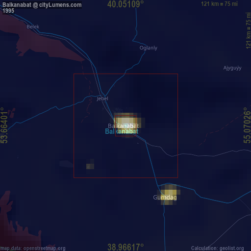
» NASA, Earths city lights 1995
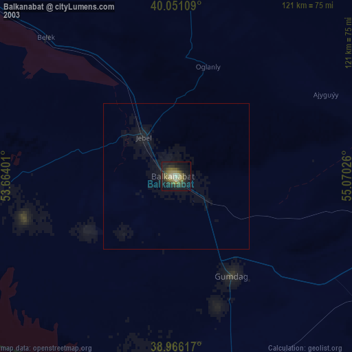
» NASA city lights 2003
» Earth at Night: Flat Maps 2012, 2016