Myrzakent night lights from space
Night Light of Myrzakent (South Kazakhstan) from space (Kazakhstan) Src. Average luminocity for 10x10km area is 2.0909% and for 50x50km: 5.2959%.
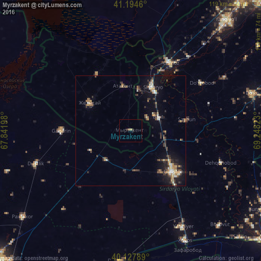
Analysis of Myrzakent night lights 2016
Square area 10x10 km:
 0%
0%90-99
0%80-89
0.49%70-79
0.81%60-69
0%50-59
0.49%40-49
0.16%30-39
0.65%20-29
0.65%10-19
0.65%0-9
96.1%Square area 50x50 km:
0.27%90-99
0.74%80-89
0.53%70-79
0.55%60-69
0.87%50-59
0.68%40-49
0.71%30-39
1.85%20-29
1.22%10-19
3.44%0-9
89.13%Clear (daylight) street map image can be seen on geolist.org.
Map coordinates:
41° 11' 40.6" North, 67° 50' 31.1" East
40° 39' 48.2" North, 68° 32' 42.4" East
40° 7' 40.4" North, 69° 14' 53.6" East
Some cities around Myrzakent sort by population:
• Guliston, UZ
27.9 km =17.3 mi,  133°
133°
• Sirdaryo, UZ
22.3 km =13.9 mi,  26°
26°
• Gagarin, UZ
31.5 km =19.6 mi,  269°
269°
• Zafar, UZ
46.4 km =28.8 mi,  40°
40°
• Chinoz, UZ
35.4 km =22 mi, 30°
• Dŭstlik, UZ
45.7 km =28.4 mi,  250°
250°
• Atakent
20.8 km =12.9 mi,  350°
350°
• Asyqata
29.9 km =18.6 mi,  329°
329°
1518945 (p: 9,752)
Sources (retrieved 2019-11-25):
» Earth at Night: Flat Maps 2012, 2016