Surin night lights from space
Night Light of Surin from space (Thailand) Src. Average luminocity for 10x10km area is 52.8636% and for 50x50km: 5.5859%.
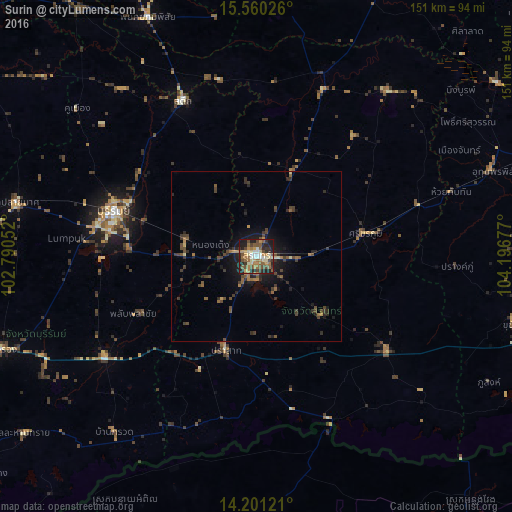
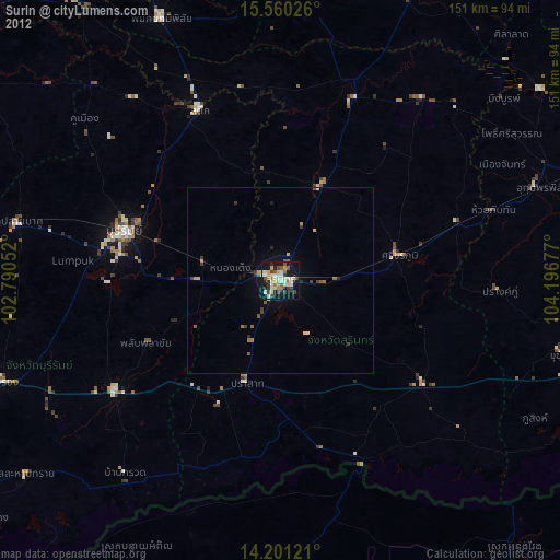
Analysis of Surin night lights 2016
Square area 10x10 km:
 5.79%
5.79%90-99
6.61%80-89
9.3%70-79
7.44%60-69
13.64%50-59
11.57%40-49
10.33%30-39
4.55%20-29
16.94%10-19
13.84%0-9
0%Square area 50x50 km:
0.23%90-99
0.31%80-89
0.54%70-79
0.5%60-69
1.12%50-59
1.07%40-49
1.7%30-39
1.52%20-29
1.79%10-19
3.87%0-9
87.36%Clear (daylight) street map image can be seen on geolist.org.
Map coordinates:
15° 33' 36.9" North, 102° 47' 25.9" East
14° 52' 54.5" North, 103° 29' 37.1" East
14° 12' 4.4" North, 104° 11' 48.4" East
Some cities around Surin sort by population:
• Buri Ram
43.7 km =27.2 mi,  286°
286°
• Nang Rong
80.2 km =49.8 mi,  250°
250°
• Samraong, KH
77.9 km =48.4 mi,  178°
178°
• Kaset Wisai
86.6 km =53.8 mi,  6°
6°
• Prakhon Chai
50.5 km =31.4 mi,  232°
232°
• Suwannaphum
86.8 km =53.9 mi,  22°
22°
• Satuek
51 km =31.7 mi,  334°
334°
• Phayakkhaphum Phisai
77.5 km =48.2 mi,  335°
335°
1606030 (p: 46,673)
Sources (retrieved 2019-11-25):
» Earth at Night: Flat Maps 2012, 2016