Prakhon Chai night lights from space
Night Light of Prakhon Chai (Buriram) from space (Thailand) Src. Average luminocity for 10x10km area is 8.7727% and for 50x50km: 2.4621%.
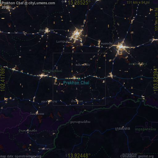
Analysis of Prakhon Chai night lights 2016
Square area 10x10 km:
 0.87%
0.87%90-99
1.08%80-89
1.08%70-79
1.73%60-69
1.95%50-59
0.65%40-49
0.87%30-39
1.3%20-29
1.08%10-19
0.65%0-9
88.74%Square area 50x50 km:
0.05%90-99
0.11%80-89
0.16%70-79
0.28%60-69
0.51%50-59
0.24%40-49
0.98%30-39
1.13%20-29
0.7%10-19
0.18%0-9
95.66%Clear (daylight) street map image can be seen on geolist.org.
Map coordinates:
15° 17' 6.9" North, 102° 25' 3.7" East
14° 36' 21.3" North, 103° 7' 14.9" East
13° 55' 28.1" North, 103° 49' 26.2" East
Some cities around Prakhon Chai sort by population:
• Surin
50.5 km =31.4 mi,  52°
52°
• Buri Ram
43.2 km =26.8 mi,  357°
357°
• Nang Rong
35.6 km =22.1 mi,  275°
275°
• Samraong, KH
63.6 km =39.5 mi,  137°
137°
• Ban Huai Thalaeng
65.7 km =40.8 mi,  309°
309°
• Soeng Sang
73.8 km =45.9 mi,  254°
254°
• Nong Ki
63.3 km =39.3 mi, 278°
• Satuek
79 km =49.1 mi,  13°
13°
1607257 (p: 15,564)
Sources (retrieved 2019-11-25):
» Earth at Night: Flat Maps 2012, 2016