Phayakkhaphum Phisai night lights from space
Night Light of Phayakkhaphum Phisai (Maha Sarakham) from space (Thailand) Src. Average luminocity for 10x10km area is 17.9351% and for 50x50km: 3.1496%.
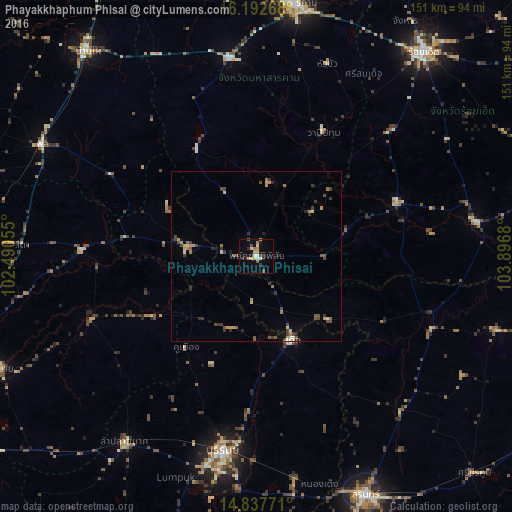
Analysis of Phayakkhaphum Phisai night lights 2016
Square area 10x10 km:
 1.08%
1.08%90-99
2.6%80-89
3.03%70-79
4.33%60-69
1.52%50-59
1.3%40-49
3.03%30-39
2.6%20-29
1.3%10-19
5.63%0-9
73.59%Square area 50x50 km:
0.1%90-99
0.24%80-89
0.41%70-79
0.59%60-69
0.45%50-59
0.5%40-49
0.77%30-39
0.78%20-29
0.59%10-19
0.46%0-9
95.1%Clear (daylight) street map image can be seen on geolist.org.
Map coordinates:
16° 11' 33.6" North, 102° 29' 26" East
15° 30' 58.7" North, 103° 11' 37.2" East
14° 50' 15.8" North, 103° 53' 48.5" East
Some cities around Phayakkhaphum Phisai sort by population:
• Maha Sarakham
75.2 km =46.7 mi,  8°
8°
• Surin
77.5 km =48.2 mi,  155°
155°
• Buri Ram
58.8 km =36.5 mi,  189°
189°
• Kaset Wisai
44.5 km =27.7 mi,  69°
69°
• Phon
71.8 km =44.6 mi,  297°
297°
• Suwannaphum
65.9 km =40.9 mi,  81°
81°
• Satuek
26.6 km =16.5 mi, 156°
• Wapi Pathum
41.5 km =25.8 mi,  28°
28°
1607763 (p: 10,212)
Sources (retrieved 2019-11-25):
» Earth at Night: Flat Maps 2012, 2016