Surat Thani night lights from space
Night Light of Surat Thani from space (Thailand) Src. Average luminocity for 10x10km area is 64.9848% and for 50x50km: 9.3431%.
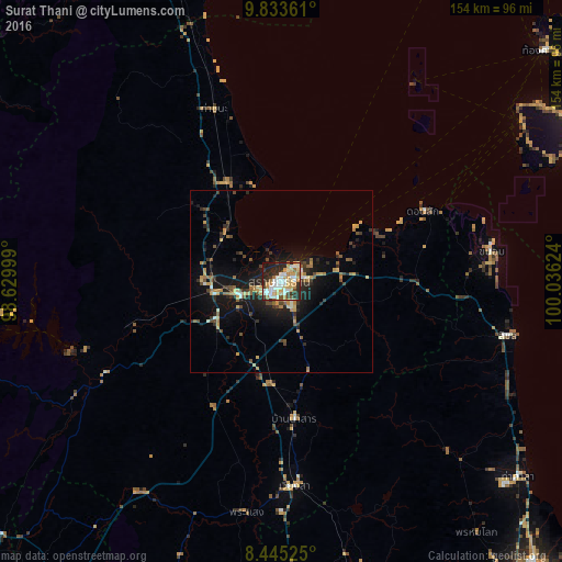
Analysis of Surat Thani night lights 2016
Square area 10x10 km:
 15.8%
15.8%90-99
16.23%80-89
10.61%70-79
12.55%60-69
7.58%50-59
1.08%40-49
4.98%30-39
5.84%20-29
19.7%10-19
5.41%0-9
0.22%Square area 50x50 km:
0.77%90-99
1.05%80-89
1.21%70-79
1.77%60-69
1.1%50-59
1.07%40-49
1.5%30-39
1.19%20-29
3.4%10-19
7.41%0-9
79.54%Clear (daylight) street map image can be seen on geolist.org.
Map coordinates:
9° 50' 1" North, 98° 37' 48" East
9° 8' 24.4" North, 99° 19' 59.2" East
8° 26' 42.9" North, 100° 2' 10.5" East
Some cities around Surat Thani sort by population:
• Ko Samui
79.4 km =49.3 mi,  56°
56°
• Tha Kham
11.6 km =7.2 mi,  253°
253°
• Ban Na San
37.9 km =23.5 mi,  174°
174°
• Don Sak
44 km =27.3 mi, 63°
• Chaiya
31.1 km =19.3 mi,  331°
331°
• Wiang Sa
56.2 km =34.9 mi,  176°
176°
• Tha Khanon
43.5 km =27 mi, 253°
• Tham Phannara
80.3 km =49.9 mi, 175°
1150515 (p: 127,201)
Sources (retrieved 2019-11-25):
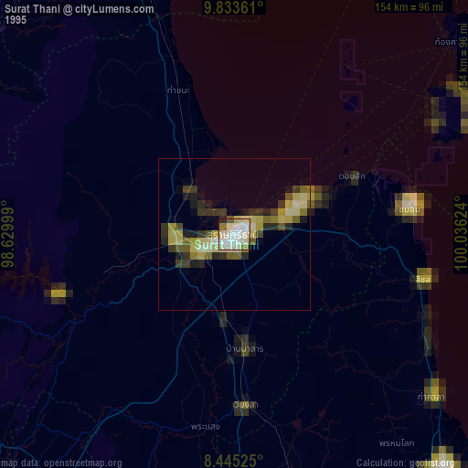
» NASA, Earths city lights 1995
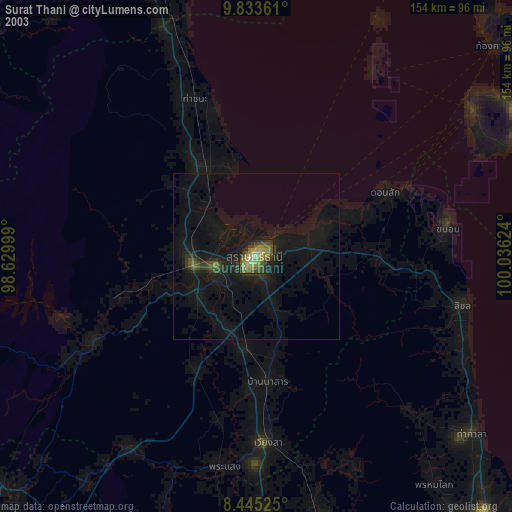
» NASA city lights 2003
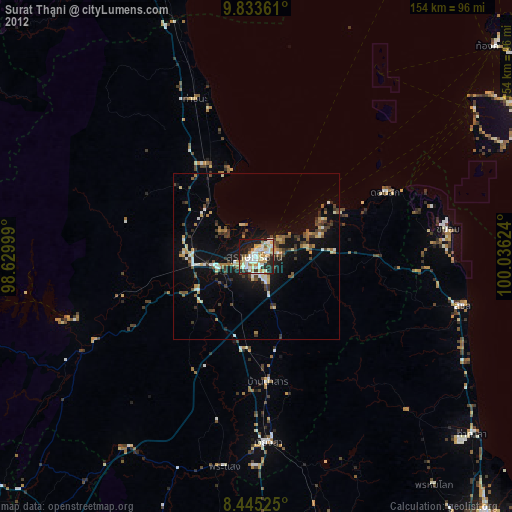
» Earth at Night: Flat Maps 2012, 2016