Tham Phannara night lights from space
Night Light of Tham Phannara (Nakhon Si Thammarat) from space (Thailand) Src. Average luminocity for 10x10km area is 1.4835% and for 50x50km: 2.162%.
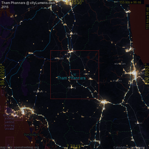
Analysis of Tham Phannara night lights 2016
Square area 10x10 km:
 0%
0%90-99
0%80-89
0%70-79
0%60-69
0%50-59
0.62%40-49
1.03%30-39
0.83%20-29
0.83%10-19
0%0-9
96.69%Square area 50x50 km:
0.06%90-99
0.14%80-89
0.29%70-79
0.37%60-69
0.36%50-59
0.32%40-49
0.42%30-39
0.53%20-29
0.75%10-19
0.31%0-9
96.44%Clear (daylight) street map image can be seen on geolist.org.
Map coordinates:
9° 6' 55.3" North, 98° 41' 31.4" East
8° 25' 13.6" North, 99° 23' 42.6" East
7° 43' 27.5" North, 100° 5' 53.9" East
Some cities around Tham Phannara sort by population:
• Nakhon Si Thammarat
62.9 km =39.1 mi,  88°
88°
• Thung Song
42.4 km =26.3 mi,  132°
132°
• Ron Phibun
57.2 km =35.5 mi,  117°
117°
• Ban Na San
42.4 km =26.3 mi,  355°
355°
• Nuea Khlong
58.3 km =36.2 mi,  228°
228°
• Wiang Sa
24.2 km =15 mi,  352°
352°
• Chawang
12.1 km =7.5 mi, 86°
• Chai Buri
35.4 km =22 mi,  277°
277°
1117557 (p: 7,119)
Sources (retrieved 2019-11-25):
» Earth at Night: Flat Maps 2012, 2016