Don Sak night lights from space
Night Light of Don Sak (Surat Thani) from space (Thailand) Src. Average luminocity for 10x10km area is 7.4545% and for 50x50km: 2.671%.
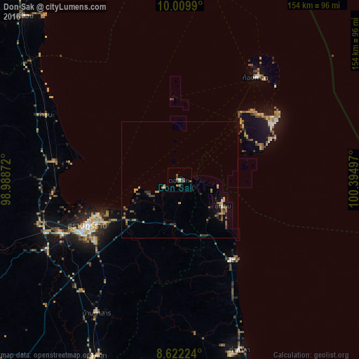
Analysis of Don Sak night lights 2016
Square area 10x10 km:
 0.65%
0.65%90-99
0.22%80-89
0.43%70-79
2.16%60-69
0.87%50-59
2.38%40-49
1.08%30-39
1.73%20-29
0.87%10-19
1.08%0-9
88.53%Square area 50x50 km:
0.05%90-99
0.08%80-89
0.39%70-79
0.45%60-69
0.39%50-59
0.76%40-49
0.41%30-39
0.65%20-29
0.49%10-19
0.71%0-9
95.61%Clear (daylight) street map image can be seen on geolist.org.
Map coordinates:
10° 0' 35.6" North, 98° 59' 19.4" East
9° 19' 0.3" North, 99° 41' 30.6" East
8° 37' 20.1" North, 100° 23' 41.9" East
Some cities around Don Sak sort by population:
• Surat Thani
44 km =27.3 mi,  243°
243°
• Ko Samui
36.2 km =22.5 mi,  47°
47°
• Tha Kham
55.4 km =34.4 mi,  245°
245°
• Ban Na San
67.8 km =42.1 mi,  212°
212°
• Chaiya
54.7 km =34 mi,  278°
278°
• Wiang Sa
83.7 km =52 mi, 205°
• Ko Pha Ngan
61.4 km =38.2 mi,  37°
37°
• Tha Khanon
87.1 km =54.1 mi, 248°
1116760 (p: 12,422)
Sources (retrieved 2019-11-25):
» Earth at Night: Flat Maps 2012, 2016