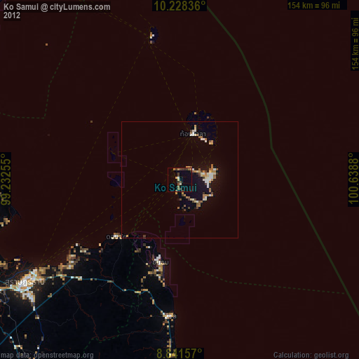
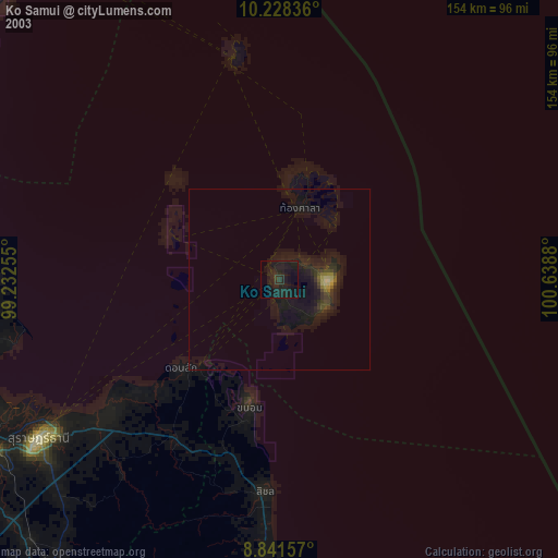
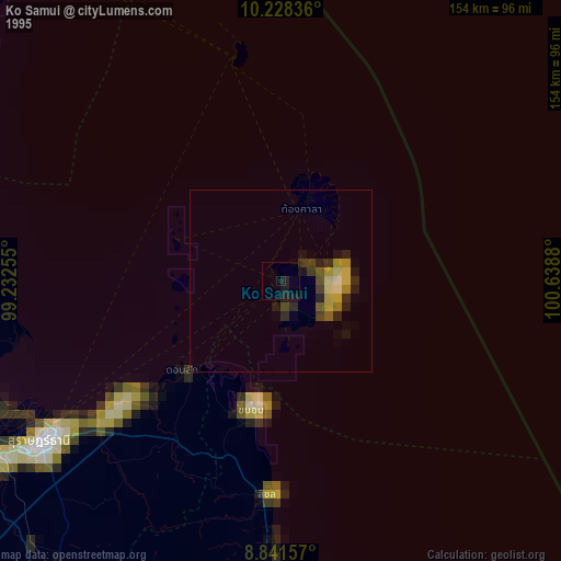
Ko Samui night lights from space
Night Light of Ko Samui (Surat Thani) from space (Thailand) Src. Average luminocity for 10x10km area is 16.1385% and for 50x50km: 4.454%.
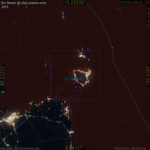
Analysis of Ko Samui night lights 2016
Square area 10x10 km:
 0%
0%90-99
0%80-89
0.87%70-79
6.06%60-69
1.73%50-59
3.46%40-49
3.68%30-39
4.11%20-29
2.6%10-19
7.14%0-9
70.35%Square area 50x50 km:
0.31%90-99
0.42%80-89
0.48%70-79
0.92%60-69
0.6%50-59
0.7%40-49
0.37%30-39
0.59%20-29
0.65%10-19
4.15%0-9
90.82%Clear (daylight) street map image can be seen on geolist.org.
Map coordinates:
10° 13' 42.1" North, 99° 13' 57.2" East
9° 32' 8.4" North, 99° 56' 8.4" East
8° 50' 29.7" North, 100° 38' 19.7" East
Some cities around Ko Samui sort by population:
• Surat Thani
79.4 km =49.3 mi,  236°
236°
• Tha Kham
90.5 km =56.2 mi, 238°
• Ban Na San
103.1 km =64.1 mi,  217°
217°
• Lang Suan
104.4 km =64.9 mi,  295°
295°
• Don Sak
36.2 km =22.5 mi,  227°
227°
• Chaiya
82.5 km =51.3 mi,  258°
258°
• Wiang Sa
118 km =73.3 mi,  211°
211°
• Ko Pha Ngan
26.7 km =16.6 mi,  22°
22°
1154689 (p: 50,000)
Sources (retrieved 2019-11-25):
» NASA, Earths city lights 1995
» NASA city lights 2003
» Earth at Night: Flat Maps 2012, 2016