Tha Khanon night lights from space
Night Light of Tha Khanon (Surat Thani) from space (Thailand) Src. Average luminocity for 10x10km area is 1.132% and for 50x50km: 1.9339%.
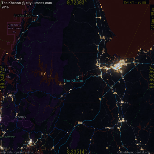
Analysis of Tha Khanon night lights 2016
Square area 10x10 km:
 0%
0%90-99
0%80-89
0%70-79
0%60-69
0%50-59
1.52%40-49
0.22%30-39
0%20-29
0%10-19
0%0-9
98.27%Square area 50x50 km:
0.07%90-99
0.16%80-89
0.14%70-79
0.37%60-69
0.42%50-59
0.35%40-49
0.37%30-39
0.31%20-29
0.52%10-19
1.14%0-9
96.16%Clear (daylight) street map image can be seen on geolist.org.
Map coordinates:
9° 43' 26.1" North, 98° 14' 59.1" East
9° 1' 48.7" North, 98° 57' 10.3" East
8° 20' 6.5" North, 99° 39' 21.6" East
Some cities around Tha Khanon sort by population:
• Surat Thani
43.5 km =27 mi,  73°
73°
• Ban Na San
51.9 km =32.2 mi,  119°
119°
• Chaiya
47.9 km =29.8 mi,  34°
34°
• Wiang Sa
63.2 km =39.3 mi,  133°
133°
• Phang Nga
79.4 km =49.3 mi,  215°
215°
• Ao Luek
76.9 km =47.8 mi,  199°
199°
• Tham Phannara
83.4 km =51.8 mi,  144°
144°
• Chai Buri
64.6 km =40.1 mi,  167°
167°
1152873 (p: 7,300)
Sources (retrieved 2019-11-25):
» Earth at Night: Flat Maps 2012, 2016