Tha Kham night lights from space
Night Light of Tha Kham (Surat Thani) from space (Thailand) Src. Average luminocity for 10x10km area is 29.1818% and for 50x50km: 8.7927%.
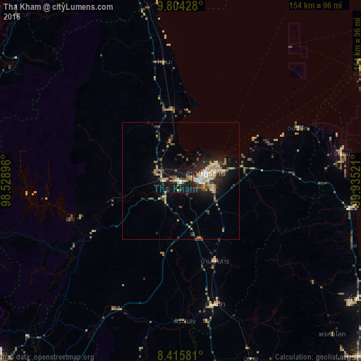
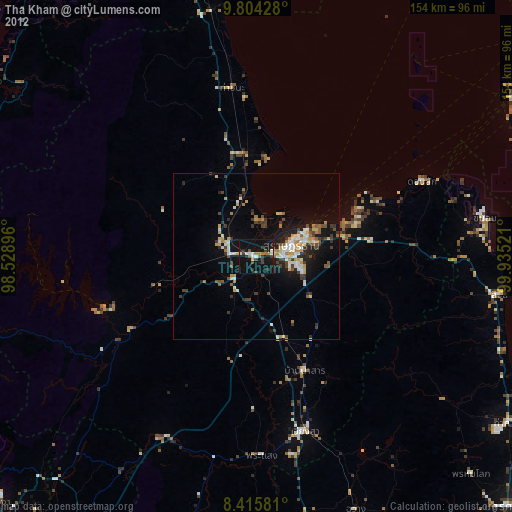
Analysis of Tha Kham night lights 2016
Square area 10x10 km:
 0.87%
0.87%90-99
2.38%80-89
5.41%70-79
3.03%60-69
3.9%50-59
5.63%40-49
4.98%30-39
3.25%20-29
10.82%10-19
55.19%0-9
4.55%Square area 50x50 km:
0.77%90-99
1.05%80-89
1.07%70-79
1.68%60-69
1.05%50-59
0.89%40-49
1.38%30-39
1.08%20-29
3.31%10-19
7.36%0-9
80.36%Clear (daylight) street map image can be seen on geolist.org.
Map coordinates:
9° 48' 15.4" North, 98° 31' 44.3" East
9° 6' 38.6" North, 99° 13' 55.5" East
8° 24' 56.9" North, 99° 56' 6.8" East
Some cities around Tha Kham sort by population:
• Surat Thani
11.6 km =7.2 mi,  73°
73°
• Ban Na San
37.4 km =23.2 mi,  157°
157°
• Don Sak
55.4 km =34.4 mi, 65°
• Chaiya
30.9 km =19.2 mi,  353°
353°
• Wiang Sa
54.8 km =34.1 mi, 164°
• Chawang
81.8 km =50.8 mi, 158°
• Tham Phannara
78.8 km =49 mi,  166°
166°
• Chai Buri
74.1 km =46 mi,  193°
193°
1151211 (p: 25,810)
Sources (retrieved 2019-11-25):
» Earth at Night: Flat Maps 2012, 2016