Khlung night lights from space
Night Light of Khlung (Chanthaburi) from space (Thailand) Src. Average luminocity for 10x10km area is 20.8037% and for 50x50km: 9.7531%.
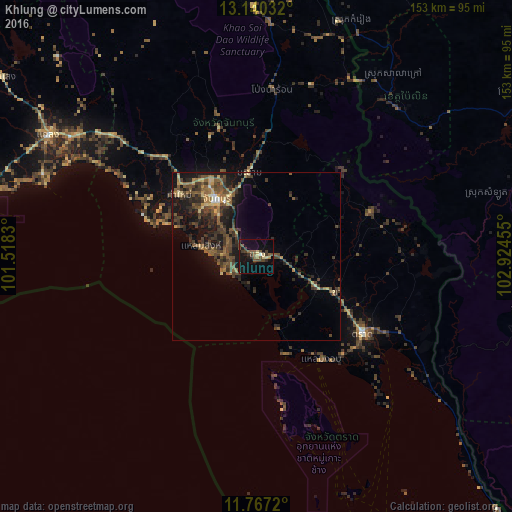
Analysis of Khlung night lights 2016
Square area 10x10 km:
 0%
0%90-99
0.83%80-89
4.13%70-79
0.41%60-69
1.45%50-59
7.44%40-49
6.61%30-39
4.34%20-29
2.89%10-19
25%0-9
46.9%Square area 50x50 km:
0.16%90-99
0.19%80-89
1.34%70-79
0.76%60-69
1.35%50-59
2.89%40-49
3.33%30-39
3.06%20-29
3.1%10-19
8.26%0-9
75.57%Clear (daylight) street map image can be seen on geolist.org.
Map coordinates:
13° 8' 25.2" North, 101° 31' 5.9" East
12° 27' 16.8" North, 102° 13' 17.1" East
11° 46' 1.9" North, 102° 55' 28.4" East
Some cities around Khlung sort by population:
• Chanthaburi
21.4 km =13.3 mi,  323°
323°
• Klaeng
71.9 km =44.7 mi,  300°
300°
• Tha Mai
29.9 km =18.6 mi,  308°
308°
• Trat
39.6 km =24.6 mi,  126°
126°
• Pailin, KH
60.8 km =37.8 mi,  43°
43°
• Laem Sing
16.3 km =10.1 mi,  280°
280°
• Bo Rai
36.7 km =22.8 mi,  69°
69°
• Pong Nam Ron
50.4 km =31.3 mi,  5°
5°
1609858 (p: 13,286)
Sources (retrieved 2019-11-25):
» Earth at Night: Flat Maps 2012, 2016