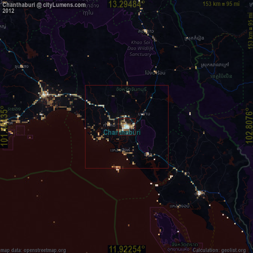
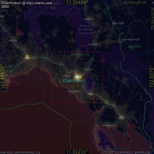
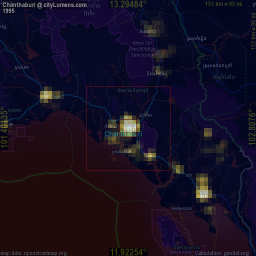
Chanthaburi night lights from space
Night Light of Chanthaburi from space (Thailand) Src. Average luminocity for 10x10km area is 56.961% and for 50x50km: 12.0686%.
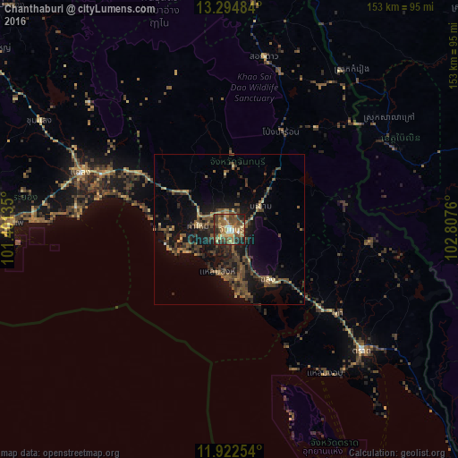
Analysis of Chanthaburi night lights 2016
Square area 10x10 km:
 4.11%
4.11%90-99
3.46%80-89
13.42%70-79
9.96%60-69
12.12%50-59
14.94%40-49
16.67%30-39
13.42%20-29
9.74%10-19
2.16%0-9
0%Square area 50x50 km:
0.16%90-99
0.21%80-89
1.61%70-79
1.07%60-69
1.66%50-59
3.35%40-49
3.93%30-39
3.65%20-29
3.58%10-19
10.77%0-9
70.02%Clear (daylight) street map image can be seen on geolist.org.
Map coordinates:
13° 17' 41.4" North, 101° 24' 4.9" East
12° 36' 34.6" North, 102° 6' 16.1" East
11° 55' 21.1" North, 102° 48' 27.4" East
Some cities around Chanthaburi sort by population:
• Klaeng
53 km =32.9 mi,  290°
290°
• Tha Mai
10.9 km =6.8 mi,  276°
276°
• Trat
60.4 km =37.5 mi,  132°
132°
• Pailin, KH
60.9 km =37.8 mi,  64°
64°
• Laem Sing
14.6 km =9.1 mi,  193°
193°
• Bo Rai
47.1 km =29.3 mi,  94°
94°
• Khlung
21.4 km =13.3 mi,  143°
143°
• Pong Nam Ron
37.1 km =23.1 mi,  27°
27°
1611269 (p: 99,819)
Sources (retrieved 2019-11-25):
» NASA, Earths city lights 1995
» NASA city lights 2003
» Earth at Night: Flat Maps 2012, 2016