Kanchanaburi night lights from space
Night Light of Kanchanaburi from space (Thailand) Src. Average luminocity for 10x10km area is 46.5368% and for 50x50km: 12.8108%.
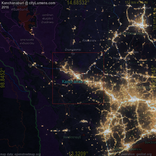

Analysis of Kanchanaburi night lights 2016
Square area 10x10 km:
 4.33%
4.33%90-99
8.23%80-89
4.33%70-79
7.79%60-69
9.74%50-59
12.77%40-49
4.76%30-39
5.84%20-29
17.1%10-19
23.59%0-9
1.52%Square area 50x50 km:
0.37%90-99
0.61%80-89
1.61%70-79
1.49%60-69
2.67%50-59
3.45%40-49
2.47%30-39
3.2%20-29
4.96%10-19
9.56%0-9
69.61%Clear (daylight) street map image can be seen on geolist.org.
Map coordinates:
14° 41' 7.2" North, 98° 50' 42.7" East
14° 0' 14.8" North, 99° 32' 54" East
13° 19' 15.2" North, 100° 15' 5.2" East
Some cities around Kanchanaburi sort by population:
• Ban Pong
41.2 km =25.6 mi,  120°
120°
• Tha Maka
26.3 km =16.3 mi, 116°
• Photharam
47.5 km =29.5 mi,  136°
136°
• Bang Phae
53.9 km =33.5 mi,  130°
130°
• Tha Muang
11.1 km =6.9 mi, 115°
• Bo Phloi
35.9 km =22.3 mi,  354°
354°
• Chom Bueng
43 km =26.7 mi,  173°
173°
• Phanom Thuan
21.4 km =13.3 mi,  49°
49°
1153081 (p: 63,699)
Sources (retrieved 2019-11-25):
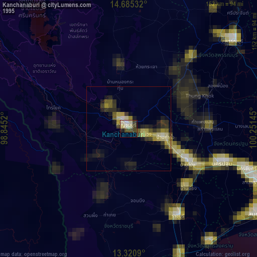
» NASA, Earths city lights 1995
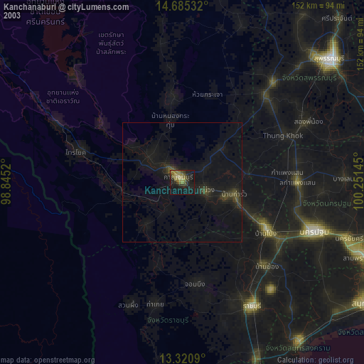
» NASA city lights 2003
» Earth at Night: Flat Maps 2012, 2016