Tha Muang night lights from space
Night Light of Tha Muang (Kanchanaburi) from space (Thailand) Src. Average luminocity for 10x10km area is 40.6467% and for 50x50km: 17.7076%.
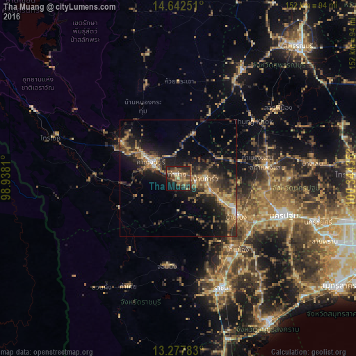
Analysis of Tha Muang night lights 2016
Square area 10x10 km:
 1.65%
1.65%90-99
0.83%80-89
3.31%70-79
7.02%60-69
9.3%50-59
14.67%40-49
14.05%30-39
8.47%20-29
14.05%10-19
21.9%0-9
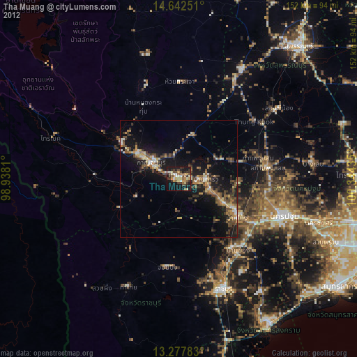
4.75%Square area 50x50 km:
0.6%90-99
0.86%80-89
2.27%70-79
2.29%60-69
3.72%50-59
4.69%40-49
3.52%30-39
4.5%20-29
7.17%10-19
12.23%0-9
58.17%Clear (daylight) street map image can be seen on geolist.org.
Map coordinates:
14° 38' 33" North, 98° 56' 17.2" East
13° 57' 40.2" North, 99° 38' 28.4" East
13° 16' 40.2" North, 100° 20' 39.7" East
Some cities around Tha Muang sort by population:
• Nakhon Pathom
46.3 km =28.8 mi,  109°
109°
• Kanchanaburi
11.1 km =6.9 mi,  295°
295°
• Ban Pong
30.2 km =18.8 mi,  122°
122°
• Photharam
37.4 km =23.2 mi,  143°
143°
• Bang Phae
43.2 km =26.8 mi,  133°
133°
• Bo Phloi
42.7 km =26.5 mi,  341°
341°
• Chom Bueng
38.3 km =23.8 mi,  188°
188°
• Phanom Thuan
19.8 km =12.3 mi,  18°
18°
1150246 (p: 26,746)
Sources (retrieved 2019-11-25):
» Earth at Night: Flat Maps 2012, 2016