Hua Hin night lights from space
Night Light of Hua Hin (Prachuap Khiri Khan) from space (Thailand) Src. Average luminocity for 10x10km area is 50.4416% and for 50x50km: 10.9391%.
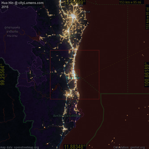
Analysis of Hua Hin night lights 2016
Square area 10x10 km:
 8.44%
8.44%90-99
8.44%80-89
9.74%70-79
8.87%60-69
5.19%50-59
4.76%40-49
7.58%30-39
6.93%20-29
17.1%10-19
20.78%0-9
2.16%Square area 50x50 km:
0.57%90-99
0.71%80-89
1.97%70-79
1.69%60-69
1.67%50-59
1.78%40-49
1.93%30-39
2.06%20-29
3.74%10-19
10.89%0-9
72.99%Clear (daylight) street map image can be seen on geolist.org.
Map coordinates:
13° 15' 21.6" North, 99° 15' 20.3" East
12° 34' 14.3" North, 99° 57' 31.5" East
11° 53' 0.5" North, 100° 39' 42.8" East
Some cities around Hua Hin sort by population:
• Cha-am
25.5 km =15.8 mi,  1°
1°
• Pran Buri
21.6 km =13.4 mi,  196°
196°
• Phetchaburi
60.2 km =37.4 mi,  358°
358°
• Tha Yang
43.4 km =27 mi,  352°
352°
• Prachuap Khiri Khan
85.5 km =53.1 mi,  192°
192°
• Sam Roi Yot
34.6 km =21.5 mi, 195°
• Kui Buri
55.4 km =34.4 mi, 191°
• Khao Yoi
75.9 km =47.2 mi, 348°
1153269 (p: 50,456)
Sources (retrieved 2019-11-25):
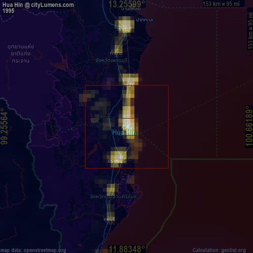
» NASA, Earths city lights 1995
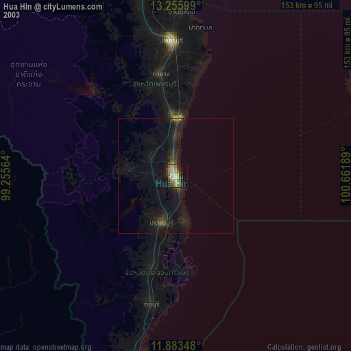
» NASA city lights 2003
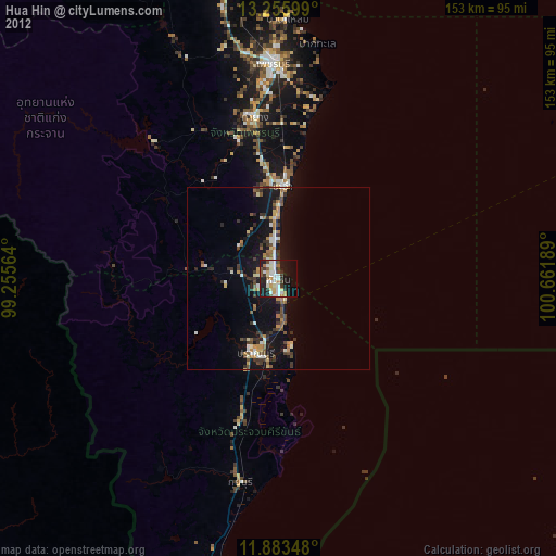
» Earth at Night: Flat Maps 2012, 2016