Khao Yoi night lights from space
Night Light of Khao Yoi (Phetchaburi) from space (Thailand) Src. Average luminocity for 10x10km area is 26.3377% and for 50x50km: 19.1238%.
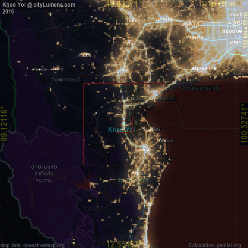
Analysis of Khao Yoi night lights 2016
Square area 10x10 km:
 0.87%
0.87%90-99
1.73%80-89
6.28%70-79
0.22%60-69
4.55%50-59
2.81%40-49
7.36%30-39
5.19%20-29
6.49%10-19
52.38%0-9
12.12%Square area 50x50 km:
0.83%90-99
1.13%80-89
2.88%70-79
3.06%60-69
3.42%50-59
3.63%40-49
3.96%30-39
5.09%20-29
7.04%10-19
16.6%0-9
52.38%Clear (daylight) street map image can be seen on geolist.org.
Map coordinates:
13° 55' 25.4" North, 99° 7' 16.2" East
13° 14' 24.9" North, 99° 49' 27.4" East
12° 33' 17.5" North, 100° 31' 38.7" East
Some cities around Khao Yoi sort by population:
• Ratchaburi
33 km =20.5 mi,  358°
358°
• Phetchaburi
19.3 km =12 mi,  137°
137°
• Tha Yang
32.6 km =20.3 mi,  164°
164°
• Ban Phaeo
49.6 km =30.8 mi,  38°
38°
• Photharam
50.3 km =31.3 mi,  3°
3°
• Samut Songkhram
27.4 km =17 mi, 44°
• Damnoen Saduak
34 km =21.1 mi,  24°
24°
• Chom Bueng
49.1 km =30.5 mi,  329°
329°
1152919 (p: 18,506)
Sources (retrieved 2019-11-25):
» Earth at Night: Flat Maps 2012, 2016