Cha-am night lights from space
Night Light of Cha-am (Phetchaburi) from space (Thailand) Src. Average luminocity for 10x10km area is 41.3896% and for 50x50km: 13.1195%.
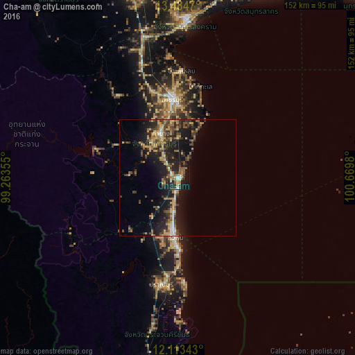
Analysis of Cha-am night lights 2016
Square area 10x10 km:
 3.46%
3.46%90-99
3.46%80-89
6.28%70-79
8.01%60-69
5.41%50-59
12.55%40-49
3.25%30-39
9.74%20-29
19.05%10-19
24.46%0-9
4.33%Square area 50x50 km:
0.52%90-99
0.6%80-89
2.45%70-79
2.12%60-69
2.03%50-59
2.23%40-49
2.5%30-39
2.98%20-29
5.07%10-19
12%0-9
67.51%Clear (daylight) street map image can be seen on geolist.org.
Map coordinates:
13° 29' 4.9" North, 99° 15' 48.8" East
12° 48' 0" North, 99° 58' 0" East
12° 6' 48.3" North, 100° 40' 11.3" East
Some cities around Cha-am sort by population:
• Hua Hin
25.5 km =15.8 mi,  181°
181°
• Pran Buri
46.7 km =29 mi,  188°
188°
• Phetchaburi
34.8 km =21.6 mi,  356°
356°
• Tha Yang
18.7 km =11.6 mi,  339°
339°
• Samut Songkhram
68.4 km =42.5 mi,  3°
3°
• Damnoen Saduak
79.9 km =49.6 mi, 359°
• Sam Roi Yot
59.7 km =37.1 mi, 189°
• Khao Yoi
51.3 km =31.9 mi, 342°
1153807 (p: 49,375)
Sources (retrieved 2019-11-25):
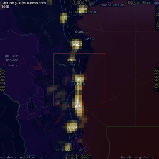
» NASA, Earths city lights 1995
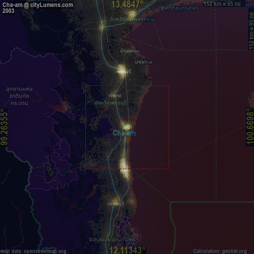
» NASA city lights 2003
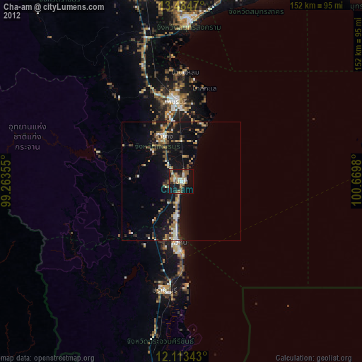
» Earth at Night: Flat Maps 2012, 2016