Phetchaburi night lights from space
Night Light of Phetchaburi from space (Thailand) Src. Average luminocity for 10x10km area is 69.3983% and for 50x50km: 18.7023%.
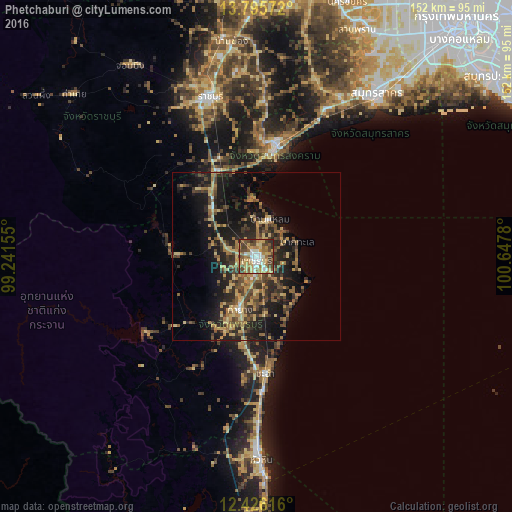
Analysis of Phetchaburi night lights 2016
Square area 10x10 km:
 10.82%
90-99
13.64%80-89
12.55%70-79
13.85%60-69
15.37%50-59
8.66%40-49
15.8%30-39
6.93%20-29
2.38%10-19
0%0-9
0%Square area 50x50 km:
0.59%90-99
0.77%80-89
3.54%70-79
3.23%60-69
3.45%50-59
3.13%40-49
4.16%30-39
4.47%20-29
7.15%10-19
14.18%0-9
55.34%Clear (daylight) street map image can be seen on geolist.org.
Map coordinates:
13° 47' 44.6" North, 99° 14' 29.6" East
13° 6' 42.8" North, 99° 56' 40.8" East
12° 25' 34.2" North, 100° 38' 52.1" East
Some cities around Phetchaburi sort by population:
• Ratchaburi
49.2 km =30.6 mi,  343°
343°
• Samut Sakhon
60.1 km =37.3 mi,  36°
36°
• Cha-am
34.8 km =21.6 mi,  176°
176°
• Tha Yang
17.7 km =11 mi,  193°
193°
• Ban Phaeo
56.1 km =34.9 mi,  18°
18°
• Samut Songkhram
34.2 km =21.3 mi,  10°
10°
• Damnoen Saduak
45.2 km =28.1 mi,  1°
1°
• Khao Yoi
19.3 km =12 mi,  317°
317°
1149698 (p: 46,601)
Sources (retrieved 2019-11-25):
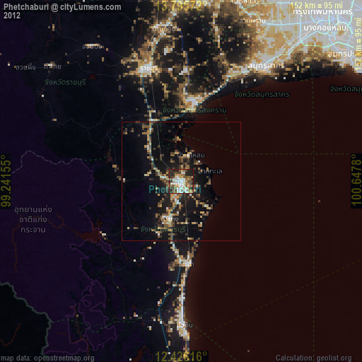
» Earth at Night: Flat Maps 2012, 2016