Bang Bo District night lights from space
Night Light of Bang Bo District (Samut Prakan) from space (Thailand) Src. Average luminocity for 10x10km area is 84.6777% and for 50x50km: 55.5707%.
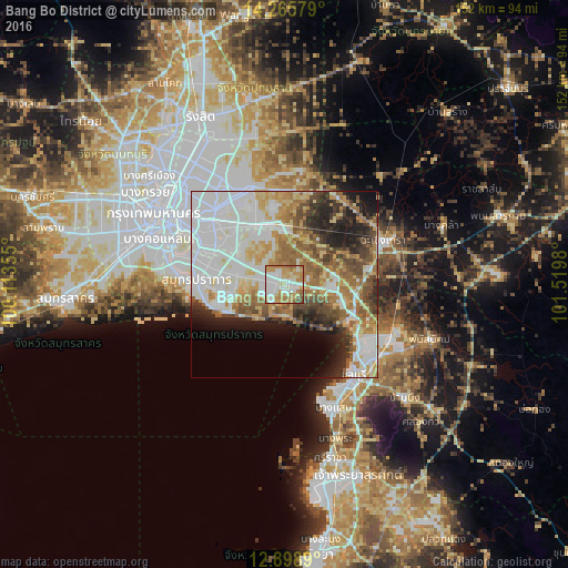
Analysis of Bang Bo District night lights 2016
Square area 10x10 km:
 27.48%
90-99
20.45%80-89
13.64%70-79
19.01%60-69
13.02%50-59
4.75%40-49
1.65%30-39
0%20-29
0%10-19
0%0-9
0%Square area 50x50 km:
18.18%90-99
11.59%80-89
6.92%70-79
6.43%60-69
8.08%50-59
6.2%40-49
5.67%30-39
4.51%20-29
6.59%10-19
6.32%0-9
19.51%Clear (daylight) street map image can be seen on geolist.org.
Map coordinates:
14° 15' 56.8" North, 100° 6' 48.8" East
13° 34' 60" North, 100° 49' 0" East
12° 53' 56" North, 101° 31' 11.3" East
Some cities around Bang Bo District sort by population:
• Bangkok
39 km =24.2 mi,  299°
299°
• Samut Prakan
23.8 km =14.8 mi,  274°
274°
• Chon Buri
30.5 km =19 mi,  143°
143°
• Phra Pradaeng
31.7 km =19.7 mi,  285°
285°
• Chachoengsao
29.9 km =18.6 mi,  67°
67°
• Ban Khlong Bang Sao Thong
6.7 km =4.2 mi,  14°
14°
• Phanat Nikhom
42.6 km =26.5 mi,  111°
111°
• Phan Thong
32.7 km =20.3 mi, 113°
1620919 (p: 28,376)
Sources (retrieved 2019-11-25):
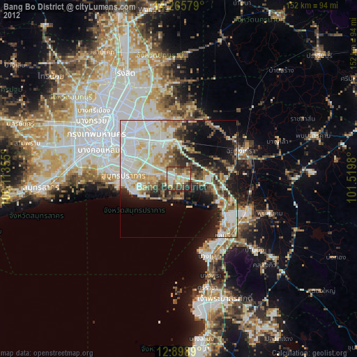
» Earth at Night: Flat Maps 2012, 2016