Bangkok night lights from space
Night Light of Bangkok from space (Thailand) Src. Average luminocity for 10x10km area is 99.8616% and for 50x50km: 89.9223%.
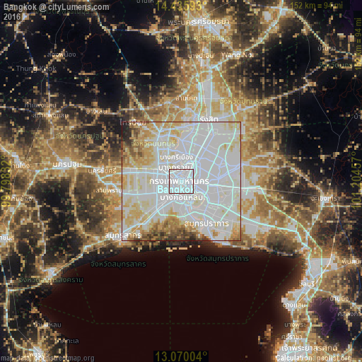
Analysis of Bangkok night lights 2016
Square area 10x10 km:
 92.98%
90-99
6.61%80-89
0.41%70-79
0%60-69
0%50-59
0%40-49
0%30-39
0%20-29
0%10-19
0%0-9
0%Square area 50x50 km:
45.44%90-99
24.64%80-89
11.01%70-79
6.94%60-69
4.51%50-59
2.53%40-49
1.89%30-39
1.59%20-29
0.98%10-19
0.47%0-9
0%Clear (daylight) street map image can be seen on geolist.org.
Map coordinates:
14° 26' 9.3" North, 99° 47' 54" East
13° 45' 14.3" North, 100° 30' 5.2" East
13° 4' 12.1" North, 101° 12' 16.5" East
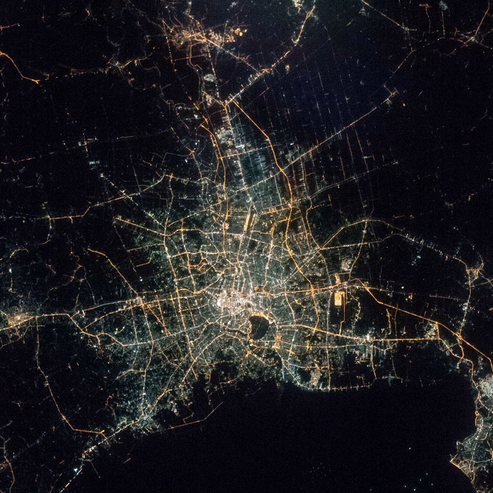
Fantastic image of Bangkok from space taken by astronauts [src2], but I don't have information about it's orientation, scale or angle. If necessary, it was rotated manually, so North points approximately to upper direction. Click to zoom in:
Some cities around Bangkok sort by population:
• Samut Prakan
20 km =12.4 mi,  149°
149°
• Mueang Nonthaburi
12 km =7.5 mi,  6°
6°
• Pak Kret
17.7 km =11 mi,  359°
359°
• Phra Pradaeng
11.2 km =7 mi,  161°
161°
• Bang Kruai
6.5 km =4 mi,  331°
331°
• Bang Bua Thong
20 km =12.4 mi,  335°
335°
• Ban Bang Kadi Pathum Thani
27.7 km =17.2 mi, 10°
• Bang Yai
18 km =11.2 mi,  303°
303°
1609350 (p: 5,104,476)
Sources (retrieved 2019-11-25):
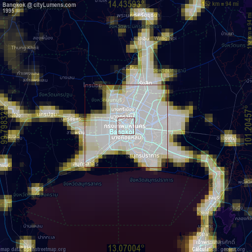
» NASA, Earths city lights 1995
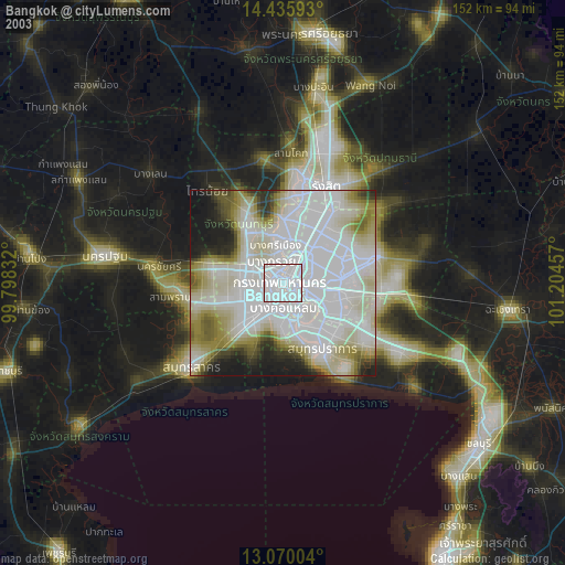
» NASA city lights 2003
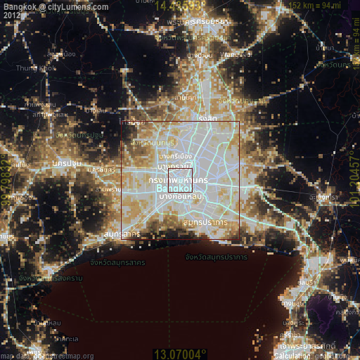
» Earth at Night: Flat Maps 2012, 2016
Src.2: Shane Kimbrough, Twitter/@astro_kimbrough