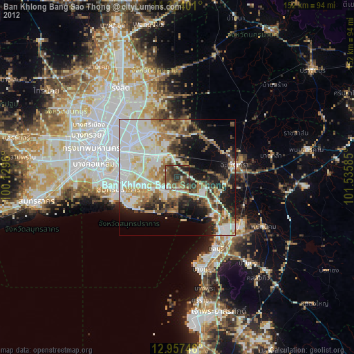
Ban Khlong Bang Sao Thong night lights from space
Night Light of Ban Khlong Bang Sao Thong (Samut Prakan) from space (Thailand) Src. Average luminocity for 10x10km area is 71.5227% and for 50x50km: 60.9201%.
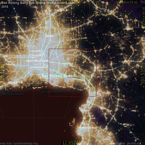
Analysis of Ban Khlong Bang Sao Thong night lights 2016
Square area 10x10 km:
 7.02%
7.02%90-99
8.26%80-89
14.88%70-79
11.78%60-69
36.16%50-59
21.9%40-49
0%30-39
0%20-29
0%10-19
0%0-9
0%Square area 50x50 km:
19.52%90-99
12.08%80-89
7.86%70-79
7.47%60-69
9.44%50-59
6.81%40-49
6.35%30-39
5.16%20-29
7.01%10-19
6.66%0-9
11.64%Clear (daylight) street map image can be seen on geolist.org.
Map coordinates:
14° 19' 26.4" North, 100° 7' 46.6" East
13° 38' 30.2" North, 100° 49' 57.8" East
12° 57' 26.9" North, 101° 32' 9.1" East
Some cities around Ban Khlong Bang Sao Thong sort by population:
• Samut Prakan
25.9 km =16.1 mi,  259°
259°
• Chon Buri
35.1 km =21.8 mi,  152°
152°
• Phra Pradaeng
32.4 km =20.1 mi,  273°
273°
• Chachoengsao
26.3 km =16.3 mi,  78°
78°
• Bang Bo District
6.7 km =4.2 mi,  194°
194°
• Bang Pakong
20.5 km =12.7 mi,  122°
122°
• Phan Thong
34.3 km =21.3 mi, 124°
• Bang Nam Priao
33 km =20.5 mi,  46°
46°
1604452 (p: 31,153)
Sources (retrieved 2019-11-25):
» Earth at Night: Flat Maps 2012, 2016