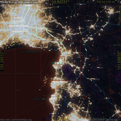
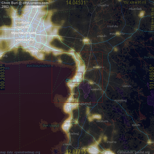
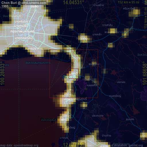
Chon Buri night lights from space
Night Light of Chon Buri from space (Thailand) Src. Average luminocity for 10x10km area is 74.9607% and for 50x50km: 38.2612%.
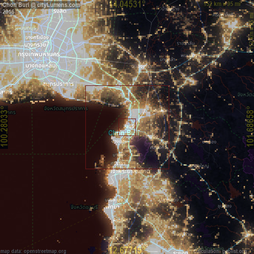
Analysis of Chon Buri night lights 2016
Square area 10x10 km:
 24.17%
90-99
24.59%80-89
7.64%70-79
8.06%60-69
7.85%50-59
6.4%40-49
1.03%30-39
7.44%20-29
9.09%10-19
3.72%0-9
0%Square area 50x50 km:
5.78%90-99
5.51%80-89
4.71%70-79
5.57%60-69
7.56%50-59
7.75%40-49
6.06%30-39
6.33%20-29
10.01%10-19
13.31%0-9
27.4%Clear (daylight) street map image can be seen on geolist.org.
Map coordinates:
14° 2' 43.1" North, 100° 16' 49.2" East
13° 21' 43.9" North, 100° 59' 0.4" East
12° 40' 37.7" North, 101° 41' 11.7" East
Some cities around Chon Buri sort by population:
• Si Racha
21.7 km =13.5 mi,  195°
195°
• Ban Khlong Bang Sao Thong
35.1 km =21.8 mi,  332°
332°
• Bang Bo District
30.5 km =19 mi,  323°
323°
• Ban Talat Bueng
32.4 km =20.1 mi,  176°
176°
• Bang Pakong
20.1 km =12.5 mi,  3°
3°
• Ban Bueng
15 km =9.3 mi,  112°
112°
• Phanat Nikhom
23.6 km =14.7 mi,  66°
66°
• Phan Thong
16.9 km =10.5 mi,  45°
45°
1611110 (p: 219,164)
Sources (retrieved 2019-11-25):
» NASA, Earths city lights 1995
» NASA city lights 2003
» Earth at Night: Flat Maps 2012, 2016