Amlamé night lights from space
Night Light of Amlamé (Plateaux) from space (Togo) Src. Average luminocity for 10x10km area is 1.3052% and for 50x50km: 0.1195%.
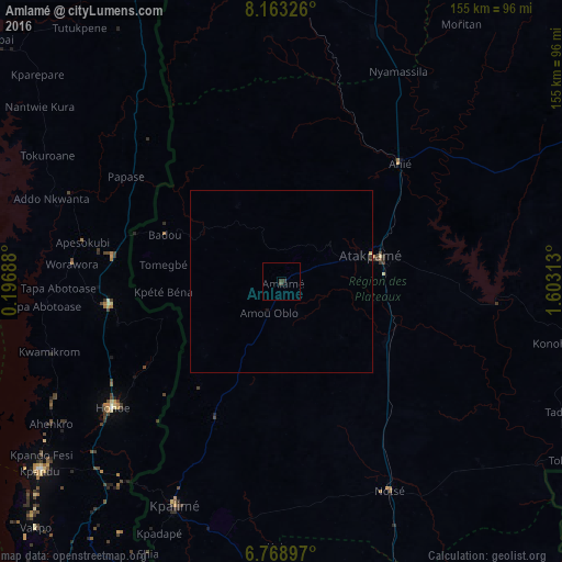
Analysis of Amlamé night lights 2016
Square area 10x10 km:
 0%
0%90-99
0%80-89
0%70-79
0%60-69
0%50-59
0%40-49
0.87%30-39
1.73%20-29
0%10-19
0.87%0-9
96.54%Square area 50x50 km:
0%90-99
0%80-89
0.03%70-79
0%60-69
0%50-59
0%40-49
0.03%30-39
0.13%20-29
0%10-19
0.07%0-9
99.73%Clear (daylight) street map image can be seen on geolist.org.
Map coordinates:
8° 9' 47.7" North, 0° 11' 48.8" East
7° 28' 0" North, 0° 54' 0" East
6° 46' 8.3" North, 1° 36' 11.3" East
Some cities around Amlamé sort by population:
• Atakpamé
26.8 km =16.7 mi,  73°
73°
• Kpalimé
69.5 km =43.2 mi,  205°
205°
• Ho, GH
107.3 km =66.7 mi, 206°
• Hohoe, GH
58.6 km =36.4 mi,  233°
233°
• Kpandu, GH
85 km =52.8 mi, 231°
• Badou
35.5 km =22.1 mi,  291°
291°
• Notsé
64.5 km =40.1 mi,  152°
152°
• Aplahoué, BJ
104.8 km =65.1 mi,  124°
124°
2368035 (p: 9,870)
Sources (retrieved 2019-11-25):
» Earth at Night: Flat Maps 2012, 2016