Qārah night lights from space
Night Light of Qārah (Rif-dimashq) from space (Syria) Src. Average luminocity for 10x10km area is 10.0733% and for 50x50km: 2.5819%.
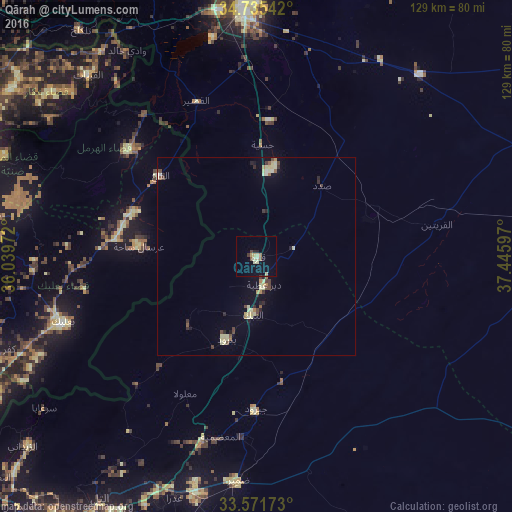
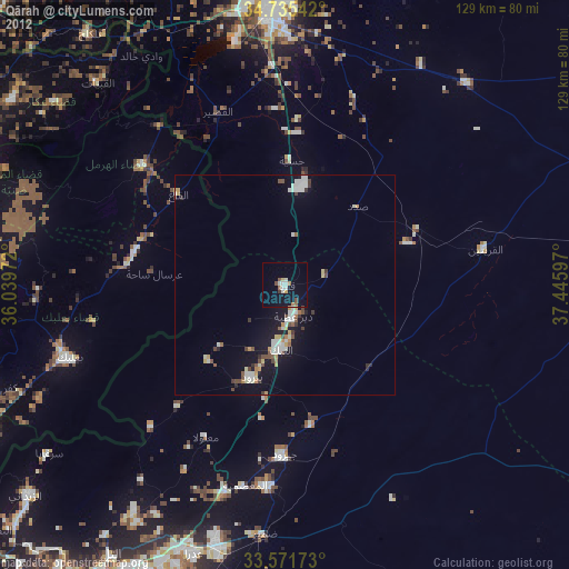
Analysis of Qārah night lights 2016
Square area 10x10 km:
 0%
0%90-99
0.92%80-89
4.03%70-79
0.92%60-69
0.37%50-59
1.83%40-49
0.73%30-39
0.73%20-29
1.47%10-19
2.01%0-9
87%Square area 50x50 km:
0.04%90-99
0.24%80-89
0.93%70-79
0.14%60-69
0.19%50-59
0.32%40-49
0.47%30-39
0.31%20-29
0.5%10-19
0.46%0-9
96.41%Clear (daylight) street map image can be seen on geolist.org.
Map coordinates:
34° 44' 7.5" North, 36° 2' 23" East
34° 9' 20.1" North, 36° 44' 34.2" East
33° 34' 18.2" North, 37° 26' 45.5" East
Some cities around Qārah sort by population:
• Homs
63.5 km =39.5 mi,  358°
358°
• An Nabk
14.7 km =9.1 mi,  185°
185°
• Al Quşayr
41.9 km =26 mi,  339°
339°
• Yabrūd
22.2 km =13.8 mi,  200°
200°
• Jayrūd
38.8 km =24.1 mi,  180°
180°
• Al Qaryatayn
46.5 km =28.9 mi,  79°
79°
• Baalbek, LB
51.1 km =31.8 mi,  250°
250°
• Al Quţayfah
48.2 km =30 mi, 195°
166111 (p: 20,656)
Sources (retrieved 2019-11-25):
» Earth at Night: Flat Maps 2012, 2016