An Nabk night lights from space
Night Light of An Nabk (Rif-dimashq) from space (Syria) Src. Average luminocity for 10x10km area is 13.1119% and for 50x50km: 2.1536%.
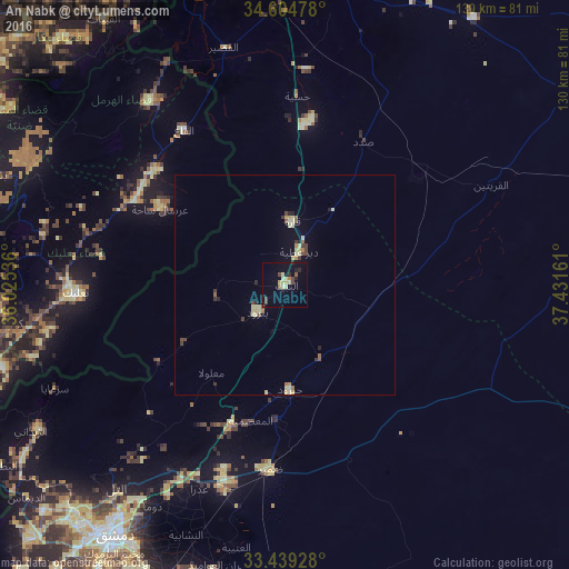
Analysis of An Nabk night lights 2016
Square area 10x10 km:
 0%
0%90-99
0.87%80-89
4.37%70-79
1.05%60-69
0.87%50-59
1.22%40-49
3.67%30-39
0%20-29
2.97%10-19
3.85%0-9
81.12%Square area 50x50 km:
0%90-99
0.1%80-89
0.82%70-79
0.2%60-69
0.22%50-59
0.24%40-49
0.43%30-39
0.26%20-29
0.33%10-19
0.36%0-9
97.04%Clear (daylight) street map image can be seen on geolist.org.
Map coordinates:
34° 36' 17.2" North, 36° 1' 31.3" East
34° 1' 26.5" North, 36° 43' 42.5" East
33° 26' 21.4" North, 37° 25' 53.8" East
Some cities around An Nabk sort by population:
• Douma
58.6 km =36.4 mi,  210°
210°
• Al Quşayr
55.5 km =34.5 mi,  345°
345°
• Yabrūd
9 km =5.6 mi,  227°
227°
• Jayrūd
24.1 km =15 mi,  177°
177°
• Al Qaryatayn
52.4 km =32.6 mi,  64°
64°
• Baalbek, LB
47.1 km =29.3 mi,  267°
267°
• Qārah
14.7 km =9.1 mi,  5°
5°
• Al Quţayfah
33.9 km =21.1 mi,  200°
200°
173193 (p: 49,372)
Sources (retrieved 2019-11-25):
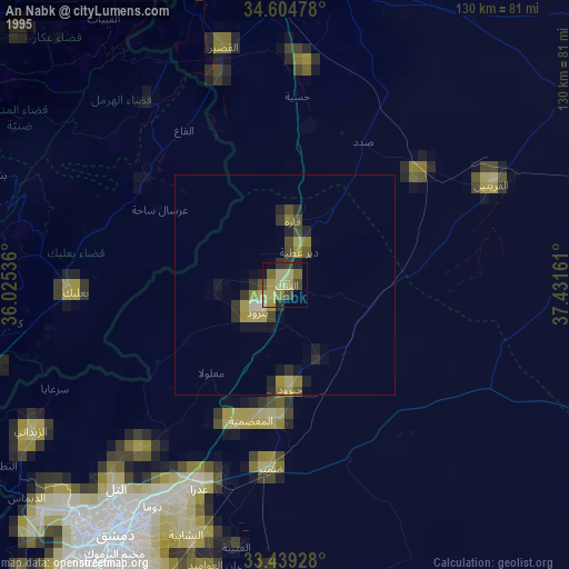
» NASA, Earths city lights 1995
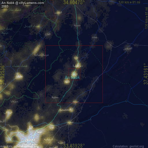
» NASA city lights 2003
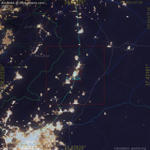
» Earth at Night: Flat Maps 2012, 2016