Sensuntepeque night lights from space
Night Light of Sensuntepeque (Cabañas) from space (El Salvador) Src. Average luminocity for 10x10km area is 3.2293% and for 50x50km: 0.8562%.
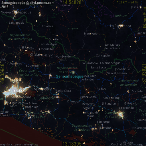
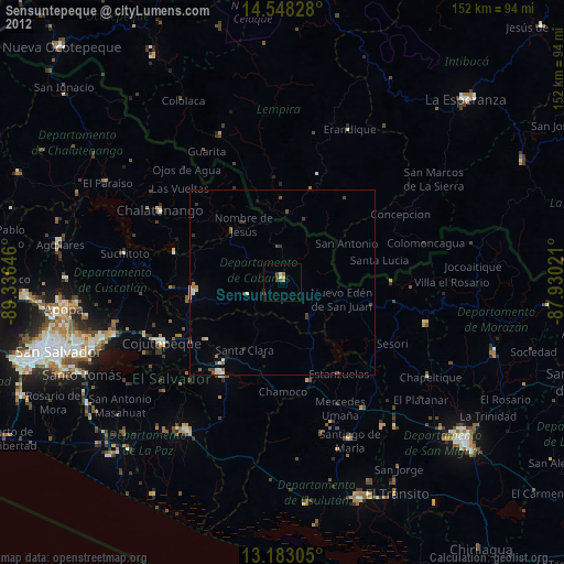
Analysis of Sensuntepeque night lights 2016
Square area 10x10 km:
 0.41%
0.41%90-99
0.41%80-89
0%70-79
0%60-69
0.83%50-59
1.45%40-49
0.21%30-39
0.83%20-29
0.83%10-19
0.83%0-9
94.21%Square area 50x50 km:
0.03%90-99
0.05%80-89
0.15%70-79
0.02%60-69
0.12%50-59
0.4%40-49
0.12%30-39
0.28%20-29
0.26%10-19
0.07%0-9
98.5%Clear (daylight) street map image can be seen on geolist.org.
Map coordinates:
14° 32' 53.8" North, 89° 20' 11.3" West
13° 52' 0" North, 88° 37' 60" West
13° 10' 59" North, 87° 55' 48.8" West
Some cities around Sensuntepeque sort by population:
• Cojutepeque
36.4 km =22.6 mi,  242°
242°
• San Vicente
31.6 km =19.6 mi,  214°
214°
• San Martín
32 km =19.9 mi,  253°
253°
• Chalatenango
37.3 km =23.2 mi,  299°
299°
• Berlín
42.2 km =26.2 mi,  165°
165°
• Ciudad Barrios
41.1 km =25.5 mi,  105°
105°
• San Sebastián
26.2 km =16.3 mi, 235°
• Apastepeque
27.5 km =17.1 mi,  216°
216°
3583158 (p: 20,386)
Sources (retrieved 2019-11-25):
» Earth at Night: Flat Maps 2012, 2016