San Vicente night lights from space
Night Light of San Vicente from space (El Salvador) Src. Average luminocity for 10x10km area is 8.8616% and for 50x50km: 1.8686%.
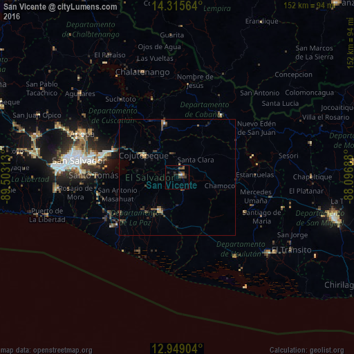
Analysis of San Vicente night lights 2016
Square area 10x10 km:
 0.41%
0.41%90-99
0.62%80-89
0.62%70-79
0.83%60-69
0.83%50-59
3.72%40-49
2.07%30-39
2.48%20-29
3.72%10-19
0.41%0-9
84.3%Square area 50x50 km:
0.05%90-99
0.06%80-89
0.16%70-79
0.17%60-69
0.22%50-59
0.55%40-49
0.5%30-39
0.76%20-29
0.64%10-19
0.35%0-9
96.54%Clear (daylight) street map image can be seen on geolist.org.
Map coordinates:
14° 18' 56.3" North, 89° 30' 11.3" West
13° 37' 60" North, 88° 48' 0" West
12° 56' 56.5" North, 88° 5' 48.8" West
Some cities around San Vicente sort by population:
• Cojutepeque
17.1 km =10.6 mi,  302°
302°
• Zacatecoluca
16.5 km =10.3 mi,  205°
205°
• San Martín
20.9 km =13 mi,  322°
322°
• Sensuntepeque
31.6 km =19.6 mi,  34°
34°
• Santiago Nonualco
20.8 km =12.9 mi,  231°
231°
• San Sebastián
11.7 km =7.3 mi,  342°
342°
• Apastepeque
4.1 km =2.5 mi, 25°
• El Rosario
29 km =18 mi,  238°
238°
3583178 (p: 41,504)
Sources (retrieved 2019-11-25):
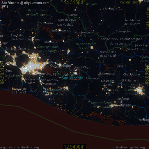
» Earth at Night: Flat Maps 2012, 2016