Soyapango night lights from space
Night Light of Soyapango (San Salvador) from space (El Salvador) Src. Average luminocity for 10x10km area is 61.657% and for 50x50km: 14.5626%.
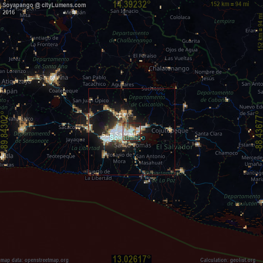
Analysis of Soyapango night lights 2016
Square area 10x10 km:
 12.19%
90-99
17.77%80-89
8.88%70-79
2.07%60-69
8.47%50-59
7.44%40-49
10.95%30-39
11.16%20-29
18.39%10-19
2.69%0-9
0%Square area 50x50 km:
2.25%90-99
2.66%80-89
1.66%70-79
1.04%60-69
1.69%50-59
2.25%40-49
2.27%30-39
2.71%20-29
4.27%10-19
9.03%0-9
70.18%Clear (daylight) street map image can be seen on geolist.org.
Map coordinates:
14° 23' 32.4" North, 89° 50' 34.9" West
13° 42' 36.9" North, 89° 8' 23.6" West
13° 1' 34.2" North, 88° 26' 12.4" West
Some cities around Soyapango sort by population:
• San Salvador
5.6 km =3.5 mi,  245°
245°
• Delgado
3.6 km =2.2 mi,  295°
295°
• San Marcos
7.4 km =4.6 mi,  219°
219°
• Cuscatancingo
5.3 km =3.3 mi, 302°
• Ilopango
3.4 km =2.1 mi,  106°
106°
• Ayutuxtepeque
8.2 km =5.1 mi, 298°
• Santo Tomás
7.8 km =4.8 mi,  174°
174°
• Tonacatepeque
8.2 km =5.1 mi,  16°
16°
3583096 (p: 329,708)
Sources (retrieved 2019-11-25):
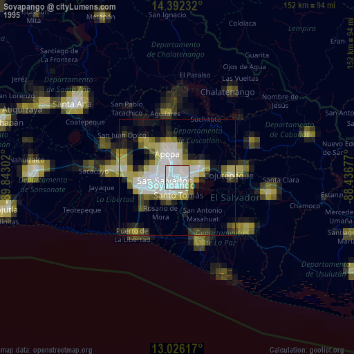
» NASA, Earths city lights 1995
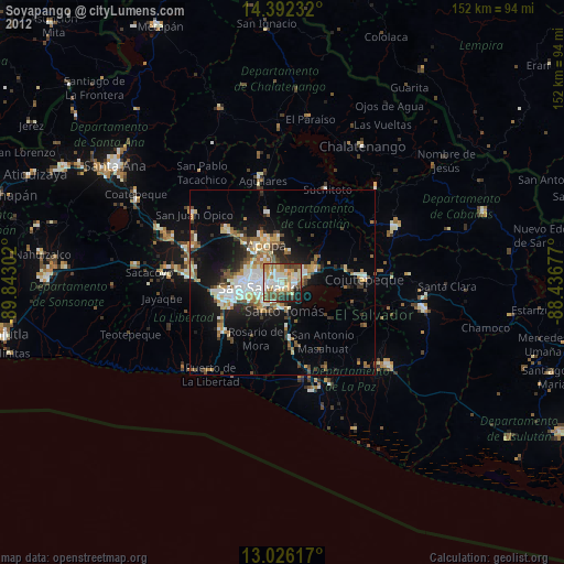
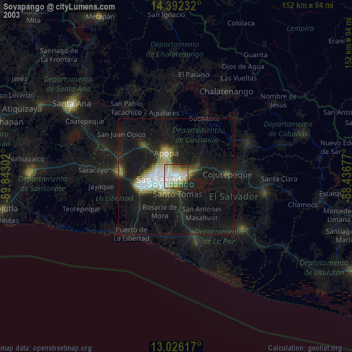
» NASA city lights 2003
» Earth at Night: Flat Maps 2012, 2016