Paramaribo night lights from space
Night Light of Paramaribo from space (Suriname) Src. Average luminocity for 10x10km area is 60.1963% and for 50x50km: 16.2309%.
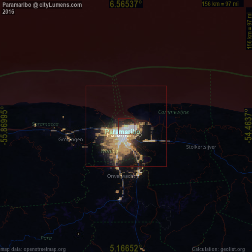
Analysis of Paramaribo night lights 2016
Square area 10x10 km:
 26.03%
90-99
16.12%80-89
5.58%70-79
2.89%60-69
1.45%50-59
0.83%40-49
3.51%30-39
5.58%20-29
16.74%10-19
17.98%0-9
3.31%Square area 50x50 km:
2.16%90-99
1.95%80-89
2.08%70-79
4.71%60-69
1.79%50-59
1.77%40-49
3.29%30-39
1.82%20-29
4.08%10-19
8.03%0-9
68.31%Clear (daylight) street map image can be seen on geolist.org.
Map coordinates:
6° 33' 55.3" North, 55° 52' 11.8" West
5° 51' 59" North, 55° 10' 0.6" West
5° 9' 59.5" North, 54° 27' 49.3" West
Some cities around Paramaribo sort by population:
• Lelydorp
19.9 km =12.4 mi,  201°
201°
• Brokopondo
92.4 km =57.4 mi,  167°
167°
• Moengo
89.2 km =55.4 mi,  108°
108°
• Nieuw Amsterdam
8.9 km =5.5 mi,  76°
76°
• Albina
129.6 km =80.5 mi, 108°
• Groningen
34 km =21.1 mi,  257°
257°
• Onverwacht
30.9 km =19.2 mi,  185°
185°
• Totness
128.2 km =79.7 mi,  270°
270°
3383330 (p: 223,757)
Sources (retrieved 2019-11-25):
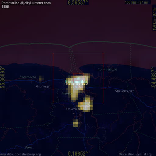
» NASA, Earths city lights 1995
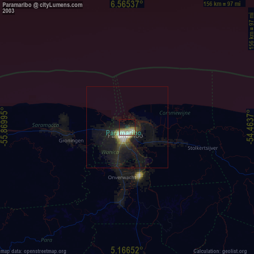
» NASA city lights 2003
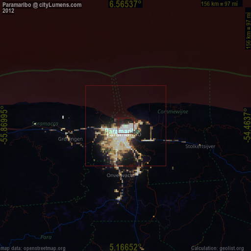
» Earth at Night: Flat Maps 2012, 2016