Lelydorp night lights from space
Night Light of Lelydorp (Wanica) from space (Suriname) Src. Average luminocity for 10x10km area is 45.6798% and for 50x50km: 17.6654%.
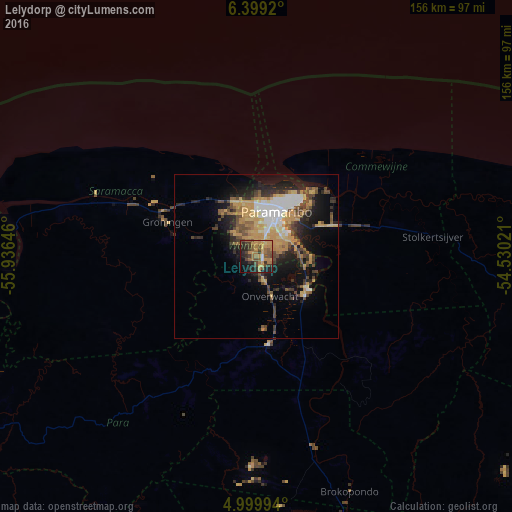
Analysis of Lelydorp night lights 2016
Square area 10x10 km:
 0.83%
0.83%90-99
0.83%80-89
4.96%70-79
18.18%60-69
12.81%50-59
10.12%40-49
10.54%30-39
7.44%20-29
11.98%10-19
17.56%0-9
4.75%Square area 50x50 km:
2.21%90-99
2.02%80-89
2.28%70-79
4.89%60-69
1.88%50-59
2.01%40-49
3.78%30-39
2.24%20-29
4.52%10-19
8.49%0-9
65.68%Clear (daylight) street map image can be seen on geolist.org.
Map coordinates:
6° 23' 57.1" North, 55° 56' 11.3" West
5° 42' 0" North, 55° 13' 60" West
4° 59' 59.8" North, 54° 31' 48.8" West
Some cities around Lelydorp sort by population:
• Paramaribo
19.9 km =12.4 mi,  21°
21°
• Brokopondo
76.9 km =47.8 mi,  158°
158°
• Moengo
92.6 km =57.5 mi,  95°
95°
• Nieuw Amsterdam
26.1 km =16.2 mi,  37°
37°
• Albina
132.3 km =82.2 mi, 99°
• Groningen
28.1 km =17.5 mi,  293°
293°
• Onverwacht
13 km =8.1 mi, 160°
• Totness
122.4 km =76.1 mi,  279°
279°
3383714 (p: 18,223)
Sources (retrieved 2019-11-25):
» Earth at Night: Flat Maps 2012, 2016