Brokopondo night lights from space
Night Light of Brokopondo from space (Suriname) Src. Average luminocity for 10x10km area is 1.5227% and for 50x50km: 0.3197%.
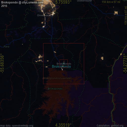
Analysis of Brokopondo night lights 2016
Square area 10x10 km:
 0%
0%90-99
0%80-89
0%70-79
0%60-69
0%50-59
0.83%40-49
1.03%30-39
1.45%20-29
0%10-19
0%0-9
96.69%Square area 50x50 km:
0%90-99
0%80-89
0.03%70-79
0.07%60-69
0%50-59
0.07%40-49
0.28%30-39
0.08%20-29
0.03%10-19
0.02%0-9
99.42%Clear (daylight) street map image can be seen on geolist.org.
Map coordinates:
5° 45' 21.3" North, 55° 41' 0.8" West
5° 3' 21.4" North, 54° 58' 49.5" West
4° 21' 18.7" North, 54° 16' 38.3" West
Some cities around Brokopondo sort by population:
• Paramaribo
92.4 km =57.4 mi,  347°
347°
• Saint-Laurent-du-Maroni, GF
116.4 km =72.3 mi,  64°
64°
• Lelydorp
76.9 km =47.8 mi,  338°
338°
• Moengo
89.2 km =55.4 mi,  45°
45°
• Nieuw Amsterdam
93 km =57.8 mi, 352°
• Albina
113.6 km =70.6 mi, 64°
• Groningen
98.7 km =61.3 mi,  326°
326°
• Onverwacht
63.9 km =39.7 mi, 338°
3384482 (p: 14,662)
Sources (retrieved 2019-11-25):
» Earth at Night: Flat Maps 2012, 2016