Wanlaweyn night lights from space
Night Light of Wanlaweyn (Lower Shabeelle) from space (Somalia) Src. Average luminocity for 10x10km area is 0.4199% and for 50x50km: 0.0168%.
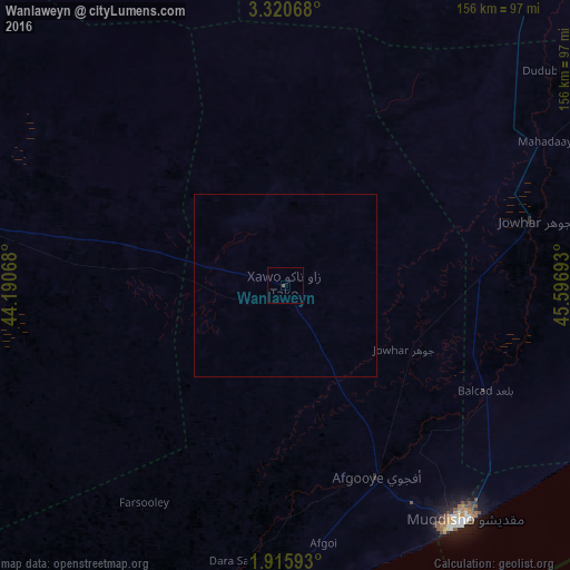
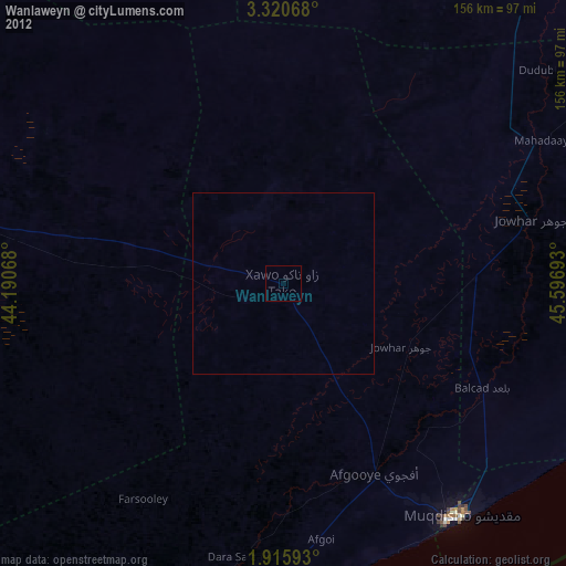
Analysis of Wanlaweyn night lights 2016
Square area 10x10 km:
 0%
0%90-99
0%80-89
0%70-79
0%60-69
0%50-59
0%40-49
0.87%30-39
0%20-29
0%10-19
0%0-9
99.13%Square area 50x50 km:
0%90-99
0%80-89
0%70-79
0%60-69
0%50-59
0%40-49
0.03%30-39
0%20-29
0%10-19
0%0-9
99.97%Clear (daylight) street map image can be seen on geolist.org.
Map coordinates:
3° 19' 14.4" North, 44° 11' 26.4" East
2° 37' 6.6" North, 44° 53' 37.7" East
1° 54' 57.3" North, 45° 35' 48.9" East
Some cities around Wanlaweyn sort by population:
• Mogadishu
81.7 km =50.8 mi,  142°
142°
• Marka
101.3 km =62.9 mi,  187°
187°
• Afgooye
59.1 km =36.7 mi,  154°
154°
• Qoryooley
100.8 km =62.6 mi,  203°
203°
• Jawhar
69.8 km =43.4 mi,  75°
75°
• Buurhakaba
92.9 km =57.7 mi,  282°
282°
• Jalalaqsi
115.1 km =71.5 mi,  42°
42°
• Mahaddayweyne
81.3 km =50.5 mi,  61°
61°
50672 (p: 22,022)
Sources (retrieved 2019-11-25):
» Earth at Night: Flat Maps 2012, 2016