Ndofane night lights from space
Night Light of Ndofane (Kaolack) from space (Senegal) Src. Average luminocity for 10x10km area is 0.3182% and for 50x50km: 0.4639%.
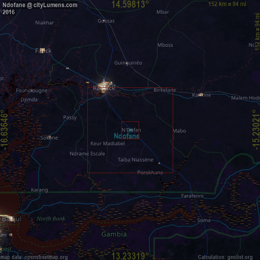
Analysis of Ndofane night lights 2016
Square area 10x10 km:
 0%
0%90-99
0%80-89
0%70-79
0%60-69
0%50-59
0%40-49
0%30-39
0%20-29
0%10-19
1.65%0-9
98.35%Square area 50x50 km:
0.01%90-99
0.06%80-89
0.05%70-79
0.05%60-69
0.02%50-59
0.07%40-49
0.19%30-39
0.02%20-29
0%10-19
0.48%0-9
99.04%Clear (daylight) street map image can be seen on geolist.org.
Map coordinates:
14° 35' 53.3" North, 16° 38' 11.3" West
13° 55' 0" North, 15° 55' 60" West
13° 13' 59.5" North, 15° 13' 48.8" West
Some cities around Ndofane sort by population:
• Kaolack
30.2 km =18.8 mi,  330°
330°
• Kaffrine
46.3 km =28.8 mi,  62°
62°
• Nioro du Rip
23.5 km =14.6 mi,  142°
142°
• Guinguinéo
39 km =24.2 mi,  357°
357°
• Sokone
46.9 km =29.1 mi,  265°
265°
• Gandiaye
50.3 km =31.3 mi,  314°
314°
• Passi
36.7 km =22.8 mi,  281°
281°
• Kerewan, GM
50.3 km =31.3 mi,  199°
199°
2247660 (p: 9,946)
Sources (retrieved 2019-11-25):
» Earth at Night: Flat Maps 2012, 2016