Passi night lights from space
Night Light of Passi (Fatick) from space (Senegal) Src. Average luminocity for 10x10km area is 0% and for 50x50km: 1.2666%.
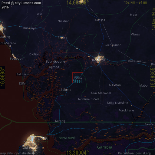
Analysis of Passi night lights 2016
Square area 10x10 km:
 0%
0%90-99
0%80-89
0%70-79
0%60-69
0%50-59
0%40-49
0%30-39
0%20-29
0%10-19
0%0-9
100%Square area 50x50 km:
0.02%90-99
0.15%80-89
0.14%70-79
0.28%60-69
0.16%50-59
0.23%40-49
0.38%30-39
0.13%20-29
0.2%10-19
0.82%0-9
97.5%Clear (daylight) street map image can be seen on geolist.org.
Map coordinates:
14° 39' 52.5" North, 16° 58' 11.3" West
13° 58' 60" North, 16° 16' 0" West
13° 18' 0.1" North, 15° 33' 48.8" West
Some cities around Passi sort by population:
• Kaolack
28.1 km =17.5 mi,  48°
48°
• Pourham
43.9 km =27.3 mi,  338°
338°
• Guinguinéo
46.5 km =28.9 mi, 47°
• Sokone
15.5 km =9.6 mi,  224°
224°
• Ndofane
36.7 km =22.8 mi,  101°
101°
• Gandiaye
27.8 km =17.3 mi,  0°
0°
• Foundiougne
27.3 km =17 mi,  307°
307°
• Fatick
41.6 km =25.8 mi, 338°
2246780 (p: 6,367)
Sources (retrieved 2019-11-25):
» Earth at Night: Flat Maps 2012, 2016