Krško night lights from space
Night Light of Krško from space (Slovenia) Src. Average luminocity for 10x10km area is 7.5699% and for 50x50km: 6.0636%.
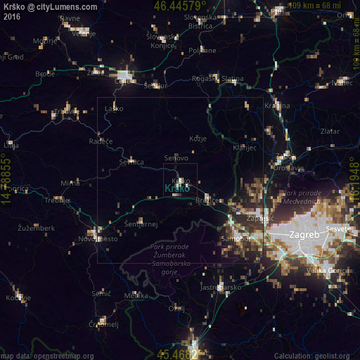
Analysis of Krško night lights 2016
Square area 10x10 km:
 0.45%
0.45%90-99
1.93%80-89
0.6%70-79
0.6%60-69
0%50-59
2.08%40-49
0.89%30-39
1.49%20-29
2.08%10-19
2.23%0-9
87.65%Square area 50x50 km:
0.61%90-99
0.69%80-89
0.42%70-79
0.59%60-69
0.88%50-59
0.99%40-49
1.59%30-39
1.66%20-29
2.81%10-19
2.91%0-9
86.85%Clear (daylight) street map image can be seen on geolist.org.
Map coordinates:
46° 26' 44.8" North, 14° 47' 18.8" East
45° 57' 32.9" North, 15° 29' 30" East
45° 28' 5.5" North, 16° 11' 41.3" East
Some cities around Krško sort by population:
• Brežice
9.9 km =6.2 mi,  128°
128°
• Sevnica
14.6 km =9.1 mi,  291°
291°
• Šentjernej
17.9 km =11.1 mi,  222°
222°
• Kostanjevica na Krki
13.7 km =8.5 mi,  203°
203°
• Kozje
13.9 km =8.6 mi,  22°
22°
• Šmarjeta
20.5 km =12.7 mi,  245°
245°
• Bistrica ob Sotli
17.3 km =10.7 mi,  50°
50°
• Škocjan
16.6 km =10.3 mi, 249°
3197147 (p: 7,097)
Sources (retrieved 2019-11-25):
» Earth at Night: Flat Maps 2012, 2016