Šmarjeta night lights from space
Night Light of Šmarjeta (Šmarješke Toplice) from space (Slovenia) Src. Average luminocity for 10x10km area is 2.2158% and for 50x50km: 1.6309%.
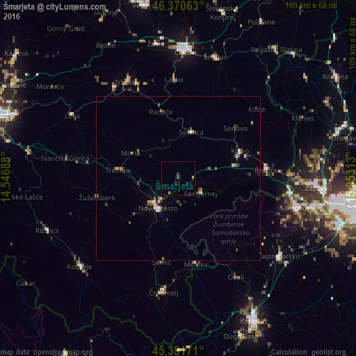
Analysis of Šmarjeta night lights 2016
Square area 10x10 km:
 0%
0%90-99
0%80-89
0%70-79
0.6%60-69
0.6%50-59
0%40-49
0.89%30-39
0.89%20-29
0%10-19
1.19%0-9
95.83%Square area 50x50 km:
0.13%90-99
0.2%80-89
0.05%70-79
0.25%60-69
0.26%50-59
0.26%40-49
0.34%30-39
0.29%20-29
0.46%10-19
0.5%0-9
97.26%Clear (daylight) street map image can be seen on geolist.org.
Map coordinates:
46° 22' 14.3" North, 14° 32' 48.8" East
45° 52' 60" North, 15° 15' 0" East
45° 23' 30.2" North, 15° 57' 11.3" East
Some cities around Šmarjeta sort by population:
• Novo Mesto
10.8 km =6.7 mi,  215°
215°
• Sevnica
14.7 km =9.1 mi,  20°
20°
• Šentjernej
8.2 km =5.1 mi,  125°
125°
• Mirna Peč
13.2 km =8.2 mi,  258°
258°
• Kostanjevica na Krki
14 km =8.7 mi,  107°
107°
• Mokronog
10.2 km =6.3 mi,  303°
303°
• Šentrupert
15.9 km =9.9 mi,  311°
311°
• Škocjan
4.1 km =2.5 mi,  50°
50°
3190506 (p: 326)
Sources (retrieved 2019-11-25):
» Earth at Night: Flat Maps 2012, 2016