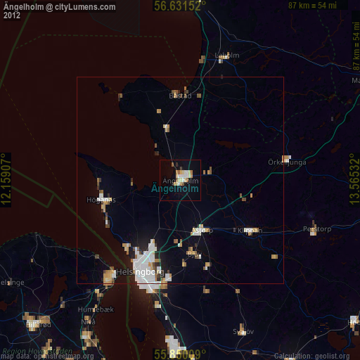
Ängelholm night lights from space
Night Light of Ängelholm (Skåne) from space (Sweden) Src. Average luminocity for 10x10km area is 22.055% and for 50x50km: 8.1895%.
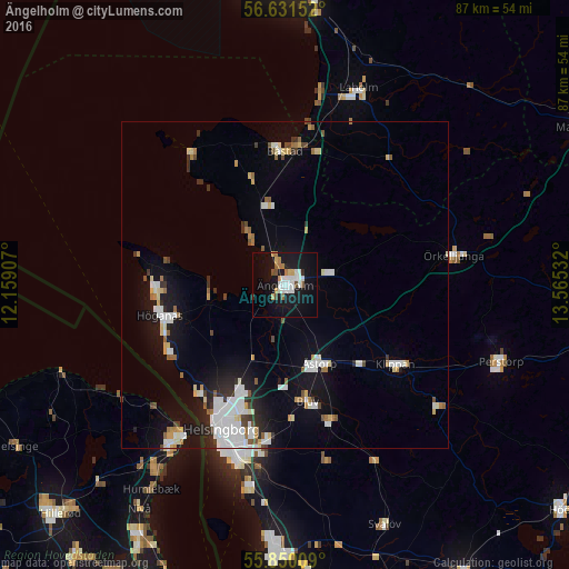
Analysis of Ängelholm night lights 2016
Square area 10x10 km:
 5.74%
5.74%90-99
3.83%80-89
1.32%70-79
2.03%60-69
2.51%50-59
1.67%40-49
1.56%30-39
0.12%20-29
1.32%10-19
28.83%0-9
51.08%Square area 50x50 km:
1.87%90-99
1.7%80-89
0.72%70-79
0.56%60-69
0.8%50-59
0.64%40-49
0.63%30-39
0.58%20-29
1.3%10-19
5.97%0-9
85.23%Clear (daylight) street map image can be seen on geolist.org.
Map coordinates:
56° 37' 53.5" North, 12° 9' 32.7" East
56° 14' 34.1" North, 12° 51' 43.9" East
55° 51' 0.3" North, 13° 33' 55.2" East
Some cities around Ängelholm sort by population:
• Helsingborg
24.2 km =15 mi,  205°
205°
• Höganäs
19.4 km =12.1 mi,  255°
255°
• Bjuv
18 km =11.2 mi,  168°
168°
• Åstorp
13 km =8.1 mi,  156°
156°
• Klippan
20.5 km =12.7 mi,  125°
125°
• Ödåkra
17 km =10.6 mi,  204°
204°
• Örkelljunga
26.1 km =16.2 mi,  80°
80°
• Båstad
20.5 km =12.7 mi,  358°
358°
2725901 (p: 23,240)
Sources (retrieved 2019-11-25):
» Earth at Night: Flat Maps 2012, 2016