Helsingborg night lights from space
Night Light of Helsingborg (Skåne) from space (Sweden) Src. Average luminocity for 10x10km area is 58.3947% and for 50x50km: 12.0966%.
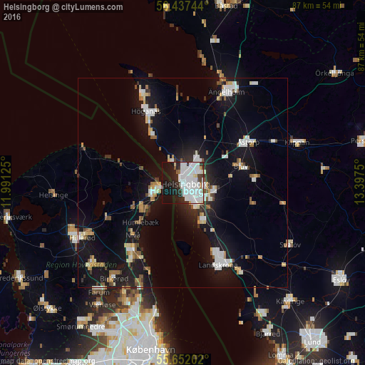
Analysis of Helsingborg night lights 2016
Square area 10x10 km:
 28.57%
90-99
18.05%80-89
1.63%70-79
0.75%60-69
1.5%50-59
1.25%40-49
2.26%30-39
3.38%20-29
11.03%10-19
22.93%0-9
8.65%Square area 50x50 km:
2.44%90-99
2.41%80-89
1%70-79
0.89%60-69
1.23%50-59
1.16%40-49
0.87%30-39
0.9%20-29
2.09%10-19
13.19%0-9
73.81%Clear (daylight) street map image can be seen on geolist.org.
Map coordinates:
56° 26' 14.8" North, 11° 59' 28.5" East
56° 2' 48.2" North, 12° 41' 39.7" East
55° 39' 7.3" North, 13° 23' 51" East
Some cities around Helsingborg sort by population:
• Espergærde, DK
10.8 km =6.7 mi,  237°
237°
• Bjuv
14.5 km =9 mi,  73°
73°
• Åstorp
18.4 km =11.4 mi,  57°
57°
• Humlebæk, DK
13.7 km =8.5 mi,  226°
226°
• Nivå, DK
17.2 km =10.7 mi,  223°
223°
• Rydebäck
10 km =6.2 mi,  153°
153°
• Hellebæk, DK
8.8 km =5.5 mi,  285°
285°
• Ödåkra
7.2 km =4.5 mi,  27°
27°
2706767 (p: 104,250)
Sources (retrieved 2019-11-25):
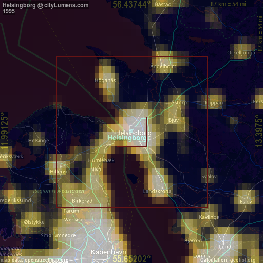
» NASA, Earths city lights 1995
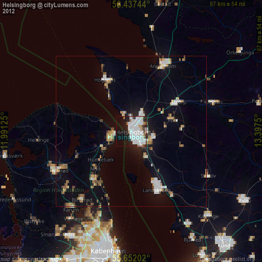
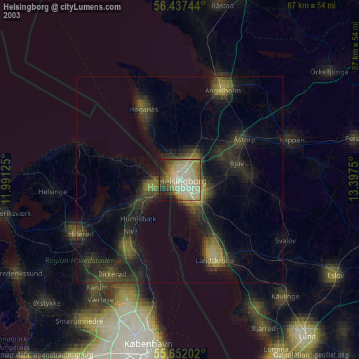
» NASA city lights 2003
» Earth at Night: Flat Maps 2012, 2016